672 results for: Lake Washington
Photograph
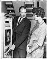
Tom Gibbs and Molly Boone checking water monitoring system, Seattle, August 31, 1963
Charles V. "Tom" Gibbs (1932-2019) was an engineer whose historic projects in the 1960s ended the constant flow of raw sewage into Lake Washington and Puget Sound. Born in Oregon and raised in Winlock, Washington, Mr. Gibbs received civil engineering degrees in 1954 and 1966 from the University of Washington (UW). He and his wife, Jean C. Gibbs, later endowed…
ID Number:2000.107.074.15.01
Date:1963
Photograph
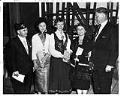
New citizens of the United States, July 4, 1963
Each year, the Immigration and Naturalization Service holds ceremonies for new immigrants to become U.S. citizens. In 1963, the July 4th naturalization ceremonies were held at the Aqua Theater at Green Lake.Here, three new citizens stand between American Legion Commander (Seattle Post 1) Dan P. Danilov and John. P. Boyd, district director of the INS, who had presented the certificates.…
ID Number:2000.107.095.22.02
Date:1963
Photograph
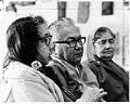
Lottie J. Fenton, Charles James, and Ione H. Knox in Seattle, May 2, 1971
This image shows Lottie J. Fenton, left, Charles James, and Ione H. Knox, all members of the Duwamish Tribe, at the Indian Center on Boren Avenue and Stewart Street. They are listening to a description as to how local Native peoples might obtain permission from the State Department of Fisheries to harvest some of the expected heavy salmon run into…
ID Number:2000.107.095.26.02
Date:1971
Photograph
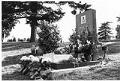
Bruce Lee's gravesite, Seattle, 1977
Legendary martial artist Lee Jun Fan (1940-1973), known professionally as Bruce Lee, was born in San Francisco, raised in Hong Kong, and attended college at the University of Washington in Seattle, before moving to back to California. During his time in Seattle Lee began teaching martial arts, and later his Hong Kong and Hollywood-produced films elevated the traditional Hong Kong…
ID Number:2000.107.111.30.01
Date:1977
Photograph
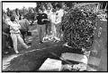
Tour group at Bruce Lee's grave, 1992
Legendary martial artist Lee Jun Fan (1940-1973), known professionally as Bruce Lee, was born in San Francisco, raised in Hong Kong, and attended college at the University of Washington in Seattle, before moving to back to California. During his time in Seattle Lee began teaching martial arts, and later his Hong Kong and Hollywood-produced films elevated the traditional Hong Kong…
ID Number:2000.107.111.30.02
Date:1992
Photograph
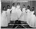
Washington Rhinestone Club débutantes at annual ball, Seattle, December 14, 1957
The brainchild of Naomi Edinburgh Murray in 1952, The Washington Rhinestone Club has presented nearly 1,100 débutantes and recognized them for their achievements and their plans to reach their career goals. Murray founded the organization along with Evelyn Smith Robinson, Laura Taylor, Mertildia Lee, and Frances Oxnard Stephens to promote positive educational and social values in the community. The First…
ID Number:2000.107.131.21.22
Date:1957
Photograph
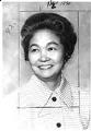
Kiyo Sakahara, Seattle, March 27, 1974
This image shows Kiyoshi (Kiyo) Sakahara (1920-2013), a leader in Seattle’s Japanese American community. She attended the University of Washington majoring in chemistry, but shortly before graduation her studies were interrupted by the forced removal of Japanese Americans. Sakahara was incarcerated in the Puyallup Assembly Center, then the Minidoka concentration camp. Sakahara and her family obtained early release and she…
ID Number:2000.107.159.13.01
Date:1974
Photograph
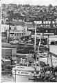
Fishing and industry in Ballard, July 12, 1976
Seattle's Ballard neighborhood was a city in its own right between 1890 and 1906. The first claim in the future city and neighborhood of Ballard was filed in 1852, the same year settlers arrived in Seattle itself. Development proceeded slowly until the influx of immigrants escaping famine and tensions in Scandinavia provided a skilled work force for local mills and…
ID Number:2000.107.165.09.02
Date:1976
Photograph
Fisherman's Terminal, Seattle, February 21, 1952
On May 17, 1952 the Port of Seattle's Fishermen's Terminal at Salmon Bay between the Interbay and Ballard neighborhoods was rededicated as the home of the Pacific Northwest fishing fleet after an expansion and modernization that allowed for moorage, drydock, repair, maintenance, and supply facilities for 1,000 vessels. This image of fishing boats docked at Fishermen's Terminal was taken facing…
ID Number:2000.107.171.31.01
Date:1952
Photograph
Band playing at Fisherman's Festival, Seattle, September 19, 1937
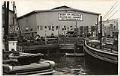
This image was taken during a performance by the Seattle Symphonic Band at the Fisherman's Festival, held September 17-18, 1937, at the Port of Seattle's Fishermen's Terminal (then Fishermen's Dock) at Salmon Bay between the Interbay and Ballard neighborhoods. The large storage shed, visible behind the revelers, had recently been competed for fishermen to hang their nets and other gear…
ID Number:2000.107.171.31.02
Date:1937