389 results for: A. D.
Cartographic material
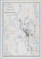
McKee's Correct Road Map of Seattle and Vicinity, 1894
Redick H. McKee (1864-1949) was born in Louisiana and spent his childhood in Washington, D.C. As a young man, Mr. McKee entered the United States Geological Survey (USGS) and was sent to the Sierra Nevadas and other parts of California. In 1892, McKee established the USGS office in Seattle, and remained a resident of the city until his death.The map…
ID Number:2019.3.12
Date:1894
Cartographic material
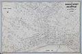
Business District of Seattle, circa 1940
In 1903 Carl Albert Kroll (1882-1982) immigrated from Germany to the U. S., finding work as a drafting technician at the Moran Brothers shipbuilding company. By 1910, Kroll was the manager at O. P. Anderson Map & Blue Print Company. The following year he acquired both the Anderson Map Company and the Washington Map and Blueprint Company to form the…
ID Number:2019.3.13
Date:Circa 1940
Cartographic material
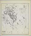
Anderson's New Guide Map of the City of Seattle & Environs, July 1890
Seattle entrepreneur and amateur photographer O. P. (Oliver Phelps) Anderson (1859-1941) was the son of Alexander Jay Anderson (1832-1903), president of the Washington Territorial University (now University of Washington) from 1877-1882. O. P. trained as a drafting technician and by 1890 had started a civil engineering and map publishing business, O. P. Anderson & Company (later O. P. Anderson Map…
ID Number:2019.3.14
Date:1890
Cartographic material
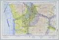
Seattle (X-1) Sectional Aeronautical Chart, April 14, 1955
Sectional Aeronautical Charts are used by aircraft pilots for navigating with Visual Flight Rules (often noted as VFR). The charts, first published in the 1930s, show important topographical and group features, along with other information such as traffic control areas, airspace classes, radio frequencies, and navigation routes. These charts, now published by the Federal Aviation Administration, were originally produced by…
ID Number:2019.3.16
Date:1955
Cartographic material
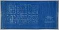
Condemnation of Lane Street et al Establishing Grades map, Seattle, July 1916
Starting in 1897 and continuing through 1930, the topography of central Seattle was radically altered by a series of regrades. An estimated 50 tons of earth removed from the city's hills were moved into the tide flats and other low areas, and into Elliott Bay.In June 1916, a bill was passed for the condemnation of property for changing and establishing…
ID Number:2019.3.21
Date:1916
Cartographic material
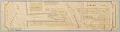
Yesler Way at Railroad Avenue map, Seattle, 1896
Seattle in the late nineteenth century was a rapidly growing city, aided in no small part by the 1883 connection to the rest of the country by the Northern Pacific Railway Company (NPRR). Additionally, the city's population doubled in 1890 from the previous year to 40,000, boosted by the influx of people who saw opportunity in rebuilding after Seattle's Great…
ID Number:2019.3.22
Date:1896
Cartographic material
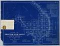
Seattle Tide Lands, Volume Two, index, 1894-1896
Seattle in the late nineteenth century was a rapidly growing city, aided in no small part by the 1883 connection to the rest of the country by the Northern Pacific Railway Company (NPRR). Additionally, the city's population doubled in 1890 from the previous year to 40,000, boosted by the influx of people who saw opportunity in rebuilding after Seattle's Great…
ID Number:2019.3.23.1
Date:1894-1895
Poster
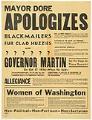
Mayor Dore Apologizes poster, Seattle, 1936
Seattle has a long history of labor radicalism dating back into the 19th century. The 1930s saw a new burst of radical labor activism, with large scale strikes and boycotting that strengthened local labor unions representing longshoremen, woodworkers, truck drivers, and machinists. As unions grew in power, so did criticism of many union leaders who utilized heavy-handed methods of recruitment…
ID Number:2019.3.39
Date:1936
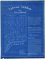
Cartographic material
Latona Addition to the City of Seattle, October 28, 1889
George Morris "Morris" Haller (1852-1889) was born in Pennsylvania to U.S. Army Colonel Granville Owen Haller (1819-1897), and his wife, Henrietta Maria (Cox) Haller (1824-1910). The family moved frequently around the country during Granville's military service, and upon his retirement in 1882, they moved to Seattle permanently. Morris studied law in Seattle and became a successful attorney and real estate…
ID Number:2019.3.48
Date:1889
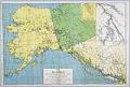
Cartographic material
Map of Alaska, Northwest Territories, and British Columbia Showing all the Recent Gold Discoveries, 1898
James D. Lowman (1856-1947) and Clarence Hanford (1857-1920) founded Lowman & Hanford Stationery and Printing Company in 1882. The firm advertised as booksellers, stationers, printers, and binders but also sold typewriters, sewing machines, pianos, and organs. Later they expanded into selling photographic equipment and other supplies to people leaving for the gold fields. The company existed in one form or…
ID Number:2019.3.58
Date:1898