480 results for: Street Views
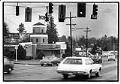
Photograph
Exterior of Jolly Roger restaurant, Seattle, March 11, 1979
A speak-easy during Prohibition called the China Castle, Seattle's last-surviving roadhouse was built in 1929 with a lookout tower and a secret tunnel. After the repeal of Prohibition it was renamed the Jolly Roger, a dining and dancing club with a skull-and-crossbones flag and neon anchor sign as beacons. Declining after WWII, the building later housed a coffee shop, an…
ID Number:2000.107.185.22.02
Date:1979
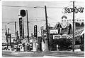
Photograph
Sambo's sign on Aurora Avenue, Seattle, July 29, 1976
The first Sambo's restaurant opened in Santa Barbara in 1957 as a low-priced pancake house catering directly to blue-collar customers. The name, a mash-up of the owner's names, was exploited for its "excellent promotional potential” in association with "Sambo," the main character of the controversial 1899 children’s book by Helen Bannerman, whose name came to be a racist slur for…
ID Number:2000.107.185.25.02
Date:1976
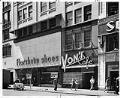
Photograph
Exterior of Von's Café on 4th Ave., Seattle, July 1, 1955
Begun by Frank Rippe (1871-1934) in 1910, Rippe's Cafe catered to Seattle's upscale late-night crowd with mahogany and brass booths and 24-hour service. Purchased in 1940 by movie theater magnate John Grey Von Herberg (1877-1947) and renamed Von's Cafe, the restaurant remained a local favorite until its closure in 1963. This image of Von's Cafe at 1421 Fourth Avenue was…
ID Number:2000.107.185.26.05
Date:1955
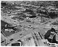
Photograph
Aerial view of South Lake Union neighborhood looking northeast, 1953
The shores of Lake Union were inhabited by the Duwamish people since time immemorial. They called the lake “meman hartshu” meaning “little lake” and had several settlements surrounding it. Seattle’s Cascade or South Lake Union (SLU) neighborhood began growing quickly in the 1880s, as the city expanded north from downtown. Industrial activity on the lake increased in the early 1900s…
ID Number:2000.107.188.36.01
Date:1953
Photograph
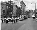
Funeral procession for Yee Wai Yee, July 14, 1953
Yee Wai Yee was a Chinese-American businessman who owned the Golden Dragon Café in Tacoma. He was also involved and well-liked in the Chinese communities of both Seattle and Tacoma. Yee was an active member of the Chinese Nationalist Party and was president of the Hop Sing Tong, a social organization among Chinese-Americans. Yee died in Sacramento on July 3,…
ID Number:2000.107.188.37.01
Date:1953
Photograph
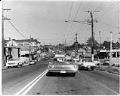
Street in the Central Area, Seattle, May 8, 1969
The Central Area (also called the Central District or the CD) is one of the oldest residential neighborhoods in Seattle. Known historically as Seattle’s Black neighborhood, other ethnic groups also called the Central Area home in the early 20th century. Urban development in the area first accelerated in the 1890s, as Seattle’s population rapidly grew. The first settlers were mostly…
ID Number:2000.107.189.01.01
Date:1969
Photograph
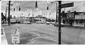
Intersection of Beacon Avenue S. and 15th Avenue S., 1974
Beacon Hill was originally inhabited by the Duwamish people, who had a village called Tal-tal-kus at the western foot of the hill. Settlers began moving onto Beacon Hill in the 1850s and growth accelerated around the turn of the 20th century. Starting in the 1920s, Chinese, Italian, and Japanese immigrants settled in Beacon Hill. After World War II, the trend…
ID Number:2000.107.189.08.01
Date:1974
Photograph
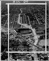
Aerial view of Empire Way and Sick's Stadium, July 11, 1953
Empire Way’s route was first laid out in 1913, as a state highway heading southeast out of Seattle. It was named for James J. Hill, the head of the Great Northern Railway, who was nicknamed the “Empire Builder.” At first, Empire Way was put together from parts of older roads on the same route. From the 1930s to the 1950s,…
ID Number:2000.107.189.11.01
Date:1953
Photograph
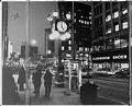
Carroll's Fine Jewelry street clock on Fourth Avenue, Seattle, January 4, 1974
This street clock was commissioned by Thomas J. Carroll, the founder of Carroll's Fine Jewelry, established in 1895 in Seattle. The clock was made by Seattle clockmakers Joseph Mayer and Sons and stood for decades at the jewelry store’s entrance at Fourth Avenue and Pike Street. Carroll's Fine Jewelry closed in 2008, and that same year the clock was donated…
ID Number:2000.107.189.13.01
Date:1974
Photograph
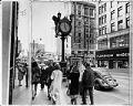
Carroll's Fine Jewelry street clock on Fourth Avenue, Seattle, January 4, 1974
This street clock was commissioned by Thomas J. Carroll, the founder of Carroll's Fine Jewelry, established in 1895 in Seattle. The clock was made by Seattle clockmakers Joseph Mayer and Sons and stood for decades at the jewelry store’s entrance at Fourth Avenue and Pike Street. Carroll's Fine Jewelry closed in 2008, and that same year the clock was donated…
ID Number:2000.107.189.13.02
Date:1974