24 results for: Moran, Robert
Cartographic material
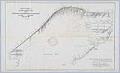
The City of Seattle Harbor Department Map of Central Waterfront District, February 1918
Maritime trade was crucial to the city's economic development, and Seattle continues to be defined and supported by the harbor that has become one of the busiest ports in the U. S. This 1918 map of Elliott Bay depicts wharves and businesses along the waterfront, as well as and water depths (soundings) along piers and in Elliott Bay. Each street,…
ID Number:2000.87.34
Date:1918
Photograph
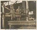
Moran Brothers Company employee with drill at the shipyard on Western Avenue, Seattle, circa 1900
Robert Moran (1857-1943) and his brothers Frank and Sherman established Moran Bros. Marine and Sawmill Machinery Co. (later Moran Bros. Co.) in Seattle in 1882. In 1898, the firm built a fleet of 12 steamers and 10 barges, and delivered them on the Yukon River to carry food to the miners. The firm also built many large steel and wood…
ID Number:2000.87.49
Date:Circa 1900
Cartographic material
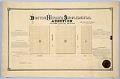
Boston Heights Supplemental Addition to the City of Seattle, February 25, 1890
Thomas Rock (1846-1908) immigrated to the U. S. from Ireland about 1870. By 1877 he was living in Seattle, and married another Irish immigrant, Mary Ann (Graham) Rock (1853-1932), and started a family. The Rocks owned property in Seattle, probably from a donation land claim granted by the U. S. government, that was platted as the Boston Heights Supplemental Addition…
ID Number:2019.3.20
Date:1890
Cartographic material
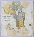
Seattle Sewerage Skeleton Map, July 1891
This 1891 map shows the proposed design for the Seattle Sewer System by Benezette Williams, a nationally renowned civil engineer who was called in by the City of Seattle to design its first municipal water system. After the Great Seattle fire in June of 1889, Seattle was forced to rethink and rebuild its water supply and fire prevention systems. Mayor…
ID Number:2019.3.27
Date:1891