25 results for: City of Seattle, Engineering Department
Cartographic material
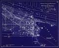
Waterway Connecting Puget Sound with Lakes Union and Washington, sheet 10, November 1904
Since the city's earliest days, Seattleites proposed canals to cheaply and easily move logs, coal, and other resources between Elliott Bay and Lake Washington. Possible routes extended from the Black River at the south end of Lake Washington to canals through Lake Union and Shilshole Bay in the north. A 1891 report commissioned by the federal government explored five possible…
ID Number:2019.3.11.11
Date:1904
Cartographic material
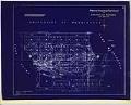
Waterway Connecting Puget Sound with Lakes Union and Washington, sheet 11, circa 1905
Since the city's earliest days, Seattleites proposed canals to cheaply and easily move logs, coal, and other resources between Elliott Bay and Lake Washington. Possible routes extended from the Black River at the south end of Lake Washington to canals through Lake Union and Shilshole Bay in the north. A 1891 report commissioned by the federal government explored five possible…
ID Number:2019.3.11.12
Date:Circa 1905
Cartographic material
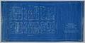
Condemnation of Lane Street et al Establishing Grades map, Seattle, July 1916
Starting in 1897 and continuing through 1930, the topography of central Seattle was radically altered by a series of regrades. An estimated 50 tons of earth removed from the city's hills were moved into the tide flats and other low areas, and into Elliott Bay.In June 1916, a bill was passed for the condemnation of property for changing and establishing…
ID Number:2019.3.21
Date:1916
Photograph
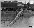
Denny Way sewer outfall into Puget Sound, Seattle, May 12, 1913
Prior to 1890, Seattle relied on a haphazard assortment of sewers and cesspools that, at best, drained into surrounding lakes and salt water. Faced with recurring threats of waterborne diseases including typhoid and cholera, City Engineer Benezette Williams designed the Seattle's first centralized combined sewage system plan in 1891. This plan sought to remove as much city sewage as possible…
ID Number:SHS8888
Date:1913
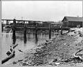
Photograph
Alder Street sewer outfall into Lake Washington, June 19, 1917
Prior to 1890, Seattle relied on a haphazard assortment of sewers and cesspools that, at best, drained into surrounding lakes and salt water. Faced with recurring threats of waterborne diseases including typhoid and cholera, City Engineer Benezette Williams designed the Seattle's first centralized combined sewage system plan in 1891. This plan sought to remove as much city sewage as possible…
ID Number:SHS8917
Date:1917