835 results for: Neighborhoods
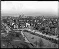
Photograph
View to the east from the Volunteer Park water tower, circa 1913
In 1906, the Seattle Water Department built a water tower at the highest point of Capitol Hill. It quickly became a popular place for people to go for a good view of the city.This photo, taken around 1913, shows the view over Capitol Hill to the east, towards Lake Washington. Holy Names Academy towers over the neighborhood's houses. Webster &…
ID Number:1983.10.8771.2
Date:Circa 1913
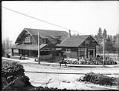
Photograph
Mount Baker Clubhouse, Seattle, circa 1914
This photo shows the Mount Baker Clubhouse on South McClellan Street in Seattle. Handwritten on sleeve: Mt. Baker Club.Photographer's Reference Number: 16536
ID Number:1983.10.8910
Date:Circa 1914
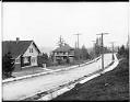
Photograph
Homes on Cascadia Avenue South, Seattle, circa 1914
Perched along the eastern rise of Mount Baker ridge, Cascadia Avenue South afforded spectacular views of Lake Washington and the Cascade Range when this residential community was developed over a century ago. Handwritten on sleeve: Mt. Baker Park, Cascade Ave.Photographer's Reference Number: 16539
ID Number:1983.10.8912
Date:Circa 1914
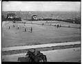
Photograph
Boys playing baseball on Queen Anne High School playfield, Seattle, circa 1914
Handwritten on sleeve: Queen Anne H.S. Playfield & Baseball.Photographer's Reference Number: 16555
ID Number:1983.10.8918.2
Date:Circa 1914
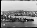
Photograph
Lake Union gasworks and University district, circa 1909
Private companies started supplying Seattle homes and businesses with natural gas in the early 1870s. At first, the gas was made from coal, which was brought in by railroad. It was used for lighting streets and buildings, as well as for cooking, heating, and manufacturing. One company built a plant at the north end of Lake Union in 1906. Parts…
ID Number:1983.10.8930.1
Date:Circa 1909
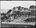
Photograph
Madrona neighborhood, Seattle, circa 1910
Handwritten on sleeve: Panorama Madrona District.Photographer's Reference Number: 16720
ID Number:1983.10.8937.1
Date:Circa 1910
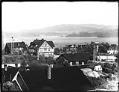
Photograph
Madrona neighborhood, Seattle, circa 1910
Handwritten on sleeve: Panorama Madrona District.Photographer's Reference Number: 16721
ID Number:1983.10.8937.2
Date:Circa 1910
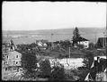
Photograph
Madrona neighborhood, Seattle, circa 1910
Handwritten on sleeve: Panorama Madrona District.Photographer's Reference Number: 16722
ID Number:1983.10.8937.3
Date:Circa 1910
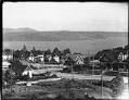
Photograph
Madrona neighborhood, Seattle, circa 1910
This view looks towards Lake Washington and shows Denny Way running from right to left with the intersection of 37th Avenue at the center left of the picture. Handwritten on sleeve: Panorama Madrona District.Photographer's Reference Number: 16723
ID Number:1983.10.8937.4
Date:Circa 1910
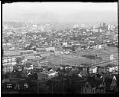
Photograph
View from Capitol Hill looking southwest, Seattle, circa 1910
Handwritten on sleeve: Pan from Cap. Hill.Webster & Stevens number: 16802
ID Number:1983.10.8950.4
Date:Circa 1910