432 results for: Construction and Urban Planning
Photograph
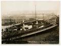
Old and New West Spokane Street Bridges, Seattle, circa 1925
From 1902 to 1917, three temporary wooden bridges were built over the west water way of the Duwamish River, connecting Harbor Island to West Seattle (annexed in 1907). This east-facing view shows one of the old wooden bridges (right) next to the permanent steel bridge (left) under construction. A lone car crosses the new bridge, a low-level bascule bridge, officially…
ID Number:2006.7.96
Date:Circa 1925
Photograph
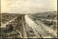
Lake Washington ship canal during construction, Seattle, May 4, 1916
After five and a half years of construction, the Lake Washington Ship Canal opened on May 8, 1917. It connects Lake Washington, Lake Union, Salmon Bay, and Puget Sound. This image looking west from Fremont shows the construction of the Lake Washington ship canal. Prominent in the center of the frame to the right of the canal is the distinctive…
ID Number:2006.7.100
Date:1916
Photograph
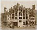
Pacific Net & Twine building under construction, Seattle, circa 1918
The Pacific Net and Twine Company (later Pacific Marine Supply, then Pacific Marine Schwabacher, Inc.) was founded in 1897 in Seattle by Scottish immigrants Edward Cunningham (1878-1960) and Donald B. McBride (1862-1945). Originally selling netting and twine out of a basement, by 1913 the company had grown and moved its operations to Pier 8. In 1918 the company moved once…
ID Number:2007.4.22
Date:Circa 1918
Photograph
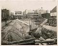
Excavation in progress for new Bon Marché building at Fourth Avenue and Pine Street, Seattle, circa 1927
The Bon Marché was founded in 1890 by German immigrant Edward Nordhoff and his wife Josephine. Originally located in Seattle’s Belltown district at First Avenue and Cedar Street, in 1896 the store moved to a more central location downtown at Second Avenue and Pike Street. The Bon Marché went through much remodeling and construction throughout the years. This photo shows…
ID Number:2009.20.158
Date:Circa 1927
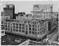
Photograph
Remodeling of the Bon Marché building on Second Avenue and Pike Street, Seattle, 1955
The Bon Marché was founded in 1890 by German immigrant Edward Nordhoff and his wife Josephine. Originally located in Seattle’s Belltown district at First Avenue and Cedar Street, in 1896 it moved to a more central location downtown at Second Avenue and Pike Street. The Bon Marché went through much remodeling and construction throughout the years. This photo was taken…
ID Number:2009.20.161.1
Date:1955
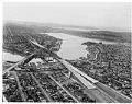
Photograph
Aerial view of Freeway Bridge during Interstate 5 construction, Seattle, January 1961
Interstate 5 (I-5) is the main Interstate Highway on the West Coast of the United States, and Seattle's widest freeway. The section of I-5 connecting Kent to Seattle to Everett was built between 1960-1966, including "Freeway Bridge," shown in this aerial photograph taken in 1961. The direction of the photograph is looking south and slightly west over Lake Union towards…
ID Number:2009.23.57
Date:1961
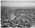
Photograph
Aerial view of Interstate 5 construction at Denny Way, looking north, January 1961
Interstate 5 (I-5) is the main Interstate Highway on the West Coast of the United States, and Seattle's and widest freeway. The section of I-5 connecting Kent to Seattle to Everett was built between 1960-1966, including the section shown in this aerial photograph taken in 1961. The direction of the photograph is looking north, Lake Union is on the left…
ID Number:2009.23.64
Date:1961
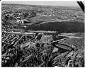
Photograph
Aerial view of Evergreen Point Floating Bridge construction, Seattle, January 18, 1962
This aerial photograph was taken during construction of the Evergreen Point Floating Bridge, on January 18, 1962. The direction is facing north, with the construction in the foreground, and Husky Stadium and the University of Washington campus beyond.The Evergreen Point Floating Bridge carries State Route 520 across Lake Washington and was second bridge to cross the lake. The bridge is…
ID Number:2009.23.101
Date:1962
Photograph
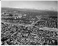
Aerial view of freeway construction, Seattle, January 18, 1962
This aerial photograph was taken during construction of Interstate 5, State Route 520, and the Evergreen Point Floating Bridge, on January 18, 1962. The direction is facing east looking towards Union Bay and Lake Washington. I-5 runs across the center of the frame with the bridge beyond. Husky Stadium and the University of Washington campus are visible in the top…
ID Number:2009.23.104
Date:1962
Photograph
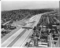
Aerial view of I-5 and 520 construction, Seattle, August 1, 1963
Interstate 5 (I-5) is the main Interstate Highway on the West Coast of the United States, and Seattle's largest and widest freeway. The section of I-5 connecting Kent to Seattle to Everett was built between 1960-1966, including the section shown in this aerial photograph taken on August 1, 1963. The direction of the photograph is looking south, and at the…
ID Number:2009.23.114
Date:1963