835 results for: Neighborhoods
Photograph
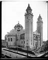
St. James Cathedral, circa 1907
St. James Cathedral was built to celebrate the move of the Roman Catholic archdiocese from Vancouver, Washington, to Seattle. The cathedral's cornerstone was laid in 1905, and the 1,400-seat building opened two years later, in 1907.This photo shows St. James Cathedral on the corner of Ninth Avenue and Marion Street on First Hill. The building and its tall towers can…
ID Number:1983.10.7640.1
Date:Circa 1907
Photograph
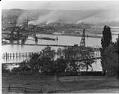
Ballard neighborhood from across Salmon Bay, Seattle, circa 1913
Note from MOHAI records: Adams School on 28th Street NW. Handwritten on sleeve: Pan - Ballard.Photographer's Reference Number: 5742
ID Number:1983.10.7659.1
Date:Circa 1913
Photograph
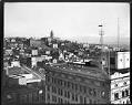
First Hill from downtown, Seattle, circa 1908
The photo was taken from the Hoge Building looking toward the King County Courthouse and "Profanity Hill." The Alaska Building stands in the foreground. Handwritten on sleeve: City View Pan.Photographer's Reference Number: 5967
ID Number:1983.10.7690
Date:Circa 1908
Photograph
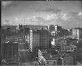
View north from Hoge Building, Seattle, circa 1908
Handwritten on sleeve: View from Hoge Bldg N.Photographer's Reference Number: 5967C
ID Number:1983.10.7693
Date:Circa 1908
Photograph
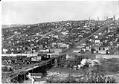
Fremont neighborhood, Seattle, circa 1906
Seattle's Fremont neighborhood, northwest of Lake Union, was named for a town in Nebraska where some of its founders hailed from. Fremont started in the 1880s as a settlement around a sawmill, and grew to a town of 5,000 before it became part of Seattle in 1891. Lake Union emptied into Salmon Bay through a narrow channel called the Outlet.…
ID Number:1983.10.7716.2
Date:Circa 1906
Photograph
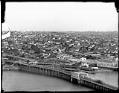
Stone Avenue Bridge and Wallingford neighborhood, Seattle, circa 1912
Before the Lake Washington Ship Canal was built, a temporary bridge on Stone Avenue carried traffic across to Fremont. Most of the bridge consisted of a wooden roadway on a trestle. The short metal span was just large enough to let logs and small boats pass through. Stone Avenue is now called Stone Way. Handwritten on sleeve: Pan Phinney Dist.Photographer's…
ID Number:1983.10.7717.1
Date:Circa 1912
Photograph
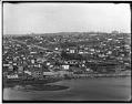
Fremont and Wallingford neighborhoods, Seattle, circa 1906
Handwritten on sleeve: Pan Phinney Dist.Photographer's Reference Number: 6093
ID Number:1983.10.7717.2
Date:Circa 1906
Photograph
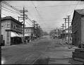
Fremont Avenue looking north, Seattle, circa 1907
Seattle's Fremont neighborhood, northwest of Lake Union, was named after a town in Nebraska where some of its early promoters hailed from. Fremont started in the 1880s as a settlement around a sawmill, and grew to a town of 5,000 before it became part of Seattle in 1891. Signs in image: Mabel E. Canney - Piano. [...] Laundry. Fremont Drug…
ID Number:1983.10.7777
Date:Circa 1907
Photograph
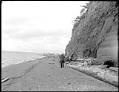
Photographer on beach near West Point Lighthouse, circa 1913
The West Point Lighthouse is located on a scenic spit of land at the foot of Seattle's Magnolia Bluff. This photo, taken around 1913, shows a photographer taking a picture of the bluff and the lighthouse. Webster & Stevens number: 7139
ID Number:1983.10.7803.1
Date:Circa 1913
Photograph
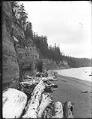
Magnolia Bluff, Seattle, circa 1913
Photo was taken near the West Point Lighthouse. Handwritten on sleeve: West Point Lighthouse.Photographer's Reference Number: 7139
ID Number:1983.10.7803.2
Date:Circa 1913