432 results for: Construction and Urban Planning
Photograph
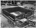
Federal Reserve Bank branch under construction, Seattle, July 21, 1949
The Federal Reserve Bank of San Francisco opened a branch in Seattle in 1917. After some years in leased space, the Seattle Branch moved into its own, purpose-built building on Second Avenue and Madison Street in 1951. The new bank had a two-story vault with 30-inch steel-reinforced concrete walls and an inner steel shell. This 1949 image shows the bank…
ID Number:2000.107.165.11.04
Date:1949
Photograph
City councilman and boy in cab of bulldozer, Seattle, December 2, 1950
In this photo, Seattle City Councilman Clarence F. Massart and eleven-year-old Jerry Abrams sit in the cab of a bulldozer during the ground-breaking ceremonies for Wallingford's new Boys' Club building at 1310 North 45th Street. The organization still occupies the same site. The Boys Clubs, now Boys & Girls Clubs of King County, was founded in 1943 and continues to…
ID Number:2000.107.171.09.07
Date:1950
Photograph
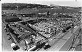
Fred Hutchinson Cancer Research Center under construction, Seattle, August 15, 1991
Seattle's world-renowned research facility, the Fred Hutchinson Cancer Research Center, was named for baseball great and hometown hero Frederick Charles "Hutch" Hutchinson (1919-1964). Begun as the Pacific Northwest Research Foundation in 1956 by Dr. William B. "Bill" Hutchinson (1909–1997), Hutch's brother, the Foundation was dedicated to the study of heart surgery, cancer, and diseases of the endocrine system. The center…
ID Number:2000.107.175.09.01
Date:1991
Photograph
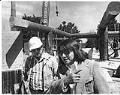
Bernie Whitebear and Pete Schnurman at Daybreak Star construction site, Seattle, June 9, 1976
In 1970, a group of activists led by Bernie Whitebear (1937-2000), Sin-Aikst, or Sinixt (now one of the Confederated Tribes of the Colville Reservation), began a protest which culminated in approval for the development of both a cultural center for Indigenous peoples and a municipal park on decommissioned surplus land at Seattle's Fort Lawton site. After several years spent raising…
ID Number:2000.107.178.13.01
Date:1976
Photograph
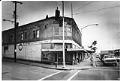
Apartment building set for demolition, Seattle, February 10, 1982
In the early 1980s, the state of Washington planned to widen the western end of Interstate 90 (I-90) and extend it to meet Interstate 5 (I-5) in Seattle’s Central Area. This expansion required the demolition of the Atlantic Street neighborhood near the I-90 overpass at Rainier Avenue. State agents began buying property in Atlantic Street and coercing residents into moving…
ID Number:2000.107.185.01.04
Date:1982
Photograph
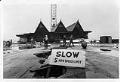
Lifting the Polynesia Restaurant, Seattle, January 25, 1982
In 1961, the Polynesia Restaurant opened at the end of Pier 51, in advance of the 1962 Seattle World’s Fair. The popular Tiki-style restaurant closed two decades later, a casualty of the expansion of the Washington State Ferry Terminal. In January 1982, after the interior fixtures and furnishings had been removed, the building was reinforced with steel I-beams and lifted…
ID Number:2000.107.185.23.04
Date:1982
Photograph
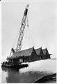
Moving the Polynesia Restaurant, Seattle, January 25, 1982
In 1961, the Polynesia Restaurant opened at the end of Pier 51, in advance of the 1962 Seattle World’s Fair. The popular Tiki-style restaurant closed two decades later, a casualty of the expansion of the Washington State Ferry Terminal. In January 1982, after the interior fixtures and furnishings had been removed, the building was reinforced with steel I-beams and lifted…
ID Number:2000.107.185.23.05
Date:1982
Photograph
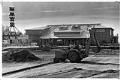
Ray's Boathouse rebuilt after fire, Seattle, March 11, 1988
One of Seattle’s landmark waterfront restaurants, Ray’s Boathouse, burned in a spectacular fire on May 26, 1987. A wiring problem beneath Ray’s pier caused plumes of smoke, which spread up into the restaurant through the kitchen floor and prompted the evacuation of customers and staff. Some 50 to 60 fire fighters, plus 20 fire trucks and boats fought the four-alarm…
ID Number:2000.107.185.24.03
Date:1988
Photograph
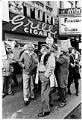
Supporters of the Turf Grill and Smoke Shop gathering for protest, Seattle, November 28, 1984
The Turf Grill and Smoke Shop opened in Seattle in the 1920s at 1407 Third Avenue. In addition to food, it sold beer and wine, cigars and cigarettes, and also had a barber shop. The Turf moved to Second and Pike in 1984 when 3rd Avenue was closed for the building of the Bus Tunnel (now the Transit Tunnel). In…
ID Number:2000.107.185.26.02
Date:1984
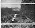
Photograph
View of sanitary landfill on 43rd. Ave. S. looking south, Seattle, December 1942
This image shows a sanitary landfill on 43rd Ave S between Genesee St. and Lake Washington Boulevard. A sanitary landfill, or fill, was a type of garbage dump in which trash was deposited, spread out and compacted, then covered in several inches of dirt. The city had proposed to expand the fill eastward to 45th Ave S, but residents of…
ID Number:2000.107.188.33.01
Date:1942