1344 results for: Seattle Center
Photograph
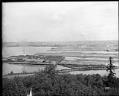
Panoramic view of Harbor Island, circa 1914
While Seattle's Harbor Island was being built, the Fisher flour mill and other industries built plants on parts of the newly-filled land.This photo is part of a larger panorama taken towards Harbor Island from West Seattle, sometime between 1912 and 1917. The Fisher flour mill and its sign can be seen on the West Waterway, in the center of the…
ID Number:1983.10.10631.1
Date:Circa 1914
Photograph
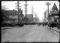
Seventh and Pike during the Strike, Seattle, February 7, 1919
The Seattle General Strike was a work stoppage by more than 65,000 workers in Seattle from February 6-11, 1919. The strike began in shipyards when workers were refused pay increases after two years of World War I wage controls. Most of the city's 110 local unions, including members of the American Federation of Labor (AFL) and the Industrial Workers of…
ID Number:1983.10.10698.1
Date:1919
Photograph
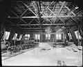
Navy pilots attending training class on UW campus, Seattle, 1918
During World War I the U. S. Navy established a temporary Naval Training Station in Seattle, on the University of Washington campus, near where the university's health sciences center is now located. The training camp was active from 1917-1919, during which time over 5,000 mostly college students were trained for both naval and naval aviation units. In this image, 11…
ID Number:1983.10.10784
Date:1918
Photograph
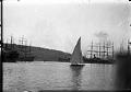
Yacht Pirate sailing on Lake Union, Seattle, April 7, 1926
The R-class racing yacht "Pirate" was designed by Ted Geary and built by the Lake Union Drydock Company in 1926. The Pirate was built for Tommy Lee, son of Los Angeles yachtsman Don Lee, as a reward for winning the Pacific Coast Star Championship in 1925, and embodies the most advanced skills and talents in both yacht design and yacht…
ID Number:1983.10.12357.2
Date:1926
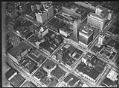
Photograph
Aerial of downtown Seattle, August 9, 1933
Prominent downtown buildings in this view include, clockwise left to right near top of frame, the Vance and 1411-4th Avenue Buildings, the United States Post Office, the Seattle Tower (formerly Northern Life Tower), the Olympic Hotel, and the White-Henry-Stuart Building. Caption on image: Laidlaw.Handwritten on sleeve: City Center showing Rhodes Dept Store, Northern Life Tower, Olympic Hotel, PO & Tel.…
ID Number:1983.10.17510
Date:1933
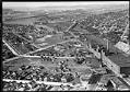
Photograph
Aerial view of Georgetown, from the south, September 19, 1933
The Georgetown district lies south of downtown Seattle, below Beacon Hill. This aerial view, looking to the north, shows the Seattle Brewing & Malting Company's Bayview Brewery and businesses along Airport Way to the right, and newly-paved S. Harney Street passing through the residential area in the foreground. Beyond S. Corson Street (center to left) are the Georgetown Elementary School…
ID Number:1983.10.17511
Date:1933
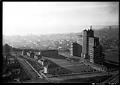
Photograph
Aerial view of Marine Hospital, Seattle, 1937
The Marine Hospital in Seattle was completed in 1932, and opened in 1933, serving veterans, merchant seamen, the U.S. Coast Guard, U.S. Light House Service, and "federal compensation cases" (the poor and indigent). Now the Pacific Tower, and previously the Pacific Medical Center, the 16-story building is located on Beacon Hill in Seattle, at 1200 12th Avenue South. Designed by…
ID Number:1983.10.17640
Date:1937
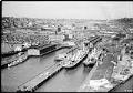
Photograph
Aerial view of Connecticut Street dock, Seattle, 1935
This aerial view of what is now Seattle's SoDo neighborhood, located just south of downtown, features docks that were owned by the Port of Seattle and utilized by shipping companies. Just north of the docks, at the left center edge of the frame, is what was then Seattle's largest Hooverville, a temporary and improvised shantytown populated by men left unemployed…
ID Number:1983.10.17702.16
Date:1935
Photograph
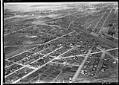
Aerial view of Georgetown from the southeast, 1936
Georgetown is located south of downtown Seattle in the Duwamish River Valley. By the time of this 1936 image, much of the river's original course had been filled in for houses, farms, and factories. Empty land created by the filling of the river’s old oxbows can be seen at the left edge of the image, bisected by South Michigan Street…
ID Number:1983.10.17774.1
Date:1936
Photograph
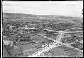
Aerial view from the southeast, looking across Georgetown to West Seattle, 1936
Georgetown is located south of downtown Seattle in the Duwamish River Valley. This image shows an area of Beacon Hill, above Georgetown's commercial area and the railroad. Seventeenth Avenue South is partially paved as it heads north, past a large natural gas storage tank and the North Coast Chemical & Soap Works plant. New sidewalks have been built along Seventeenth…
ID Number:1983.10.17774.3
Date:1936