396 results for: Central Area

Photograph
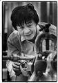
Women learning keypunch at SOIC, January 1979
The Seattle Opportunities Industrialization Center, or SOIC (pronounced "So I see"), was established in 1966, largely through a grant from the Office of Economic Opportunity, the federal agency funding "war on poverty" programs. Modeled after the original OIC started by a Philadelphia minister two years earlier, the community-based program recruited, trained, and placed unemployed people in the labor market. The…
ID Number:2000.107.177.26.03
Date:1979
Photograph
Plumbing student at SOIC, January 15, 1979
The Seattle Opportunities Industrialization Center, or SOIC (pronounced "So I see"), was established in 1966, largely through a grant from the Office of Economic Opportunity, the federal agency funding "war on poverty" programs. Modeled after the original OIC started by a Philadelphia minister two years earlier, the community-based program recruited, trained and placed unemployed people in the labor market. The…
ID Number:2000.107.177.26.04
Date:1979
Photograph
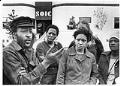
Students complaining about problems at SOIC, April 21, 1980
The Seattle Opportunities Industrialization Center, or SOIC (pronounced "So I see"), was established in 1966, largely through a grant from the Office of Economic Opportunity, the federal agency funding "war on poverty" programs. Modeled after the original OIC started by a Philadelphia minister two years earlier, the community-based program recruited, trained and placed unemployed people in the labor market. The…
ID Number:2000.107.177.26.05
Date:1980
Photograph
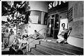
Teacher and class on steps of closed SOIC building, August 1986
The Seattle Opportunities Industrialization Center, or SOIC (pronounced "So I see"), was established in 1966, largely through a grant from the Office of Economic Opportunity, the federal agency funding "war on poverty" programs. Modeled after the original OIC started by a Philadelphia minister two years earlier, the community-based program recruited, trained and placed unemployed people in the labor market. The…
ID Number:2000.107.177.26.06
Date:1986
Photograph
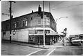
Apartment building set for demolition, Seattle, February 10, 1982
In the early 1980s, the state of Washington planned to widen the western end of Interstate 90 (I-90) and extend it to meet Interstate 5 (I-5) in Seattle’s Central Area. This expansion required the demolition of the Atlantic Street neighborhood near the I-90 overpass at Rainier Avenue. State agents began buying property in Atlantic Street and coercing residents into moving…
ID Number:2000.107.185.01.04
Date:1982
Photograph
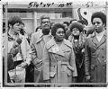
Ethel Mitchell announcing the formation of the Black Alliance of Educators, Seattle, March 4, 1972
In the 1960s, after decades of discrimination in housing had created an increasingly segregated school system in Seattle, civil rights activists wanted the School Board to promote integration and, with it, intercultural empathy and understanding. After various attempts to promote voluntary integration, and faced with the threat of legal action from advocates of integration, in 1972 the School District launched…
ID Number:2000.107.185.38.01
Date:1972
Photograph
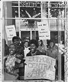
Garfield students picketing at Seattle Public School's Administrative and Service Center, May 28, 1976
In this image taken outside the Seattle School District's Administrative and Service Center, students from Garfield High School protest minority staff transfers planned to comply with federal regulations on equal minority staffing throughout the district. The protest was part of a boycott of Central Area schools, which emptied classrooms in the area's 13 schools. Caption information source: The Seattle Times,…
ID Number:2000.107.186.01.01
Date:1976
Photograph
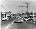
Street in the Central Area, Seattle, May 8, 1969
The Central Area (also called the Central District or the CD) is one of the oldest residential neighborhoods in Seattle. Known historically as Seattle’s Black neighborhood, other ethnic groups also called the Central Area home in the early 20th century. Urban development in the area first accelerated in the 1890s, as Seattle’s population rapidly grew. The first settlers were mostly…
ID Number:2000.107.189.01.01
Date:1969
Menu
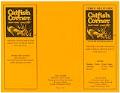
Catfish Corner menu, 1997
Woodrow (Woody) and Rosemary (Rosie) Jackson opened their Catfish Corner restaurant at 2726 E. Cherry St and Martin Luther King, Jr. Way in 1985, specializing in “Southern, farm-raised catfish.” The Jacksons sold the business to new owners in 2009, but the popular restaurant closed due to financial difficulties in 2014. In 2021, Woody and Rosie’s grandson Terrell Jackson opened “Jackson’s…
ID Number:2000.107.189.14.03
Date:1997
Photograph
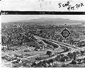
View of Rainier Avenue and Lake Way looking east, March 1954
Seattle's Atlantic neighborhood (which has also been referred to as Yesler/Atlantic and Judkins Park) is a triangular community in the Central District area, between Mount Baker Ridge and Beacon Hill. One of oldest residential neighborhoods, it was home to Seattle's largest Italian enclaves during the early years of the twentieth century. Like other neighborhoods in central and southeast Seattle, Black…
ID Number:2000.107.189.16.01
Date:1954