1868 results for: Seattle Times
Cartographic material
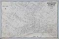
Business District of Seattle, circa 1940
In 1903 Carl Albert Kroll (1882-1982) immigrated from Germany to the U. S., finding work as a drafting technician at the Moran Brothers shipbuilding company. By 1910, Kroll was the manager at O. P. Anderson Map & Blue Print Company. The following year he acquired both the Anderson Map Company and the Washington Map and Blueprint Company to form the…
ID Number:2019.3.13
Date:Circa 1940
Cartographic material
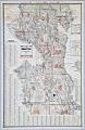
Seattle, Washington, Postal delivery section map, circa 1950
In 1903 Carl Albert Kroll (1882-1982) immigrated from Germany to the U. S., finding work as a drafting technician at the Moran Brothers shipbuilding company. By 1910 Kroll was the manager at O. P. Anderson Map & Blue Print Company. The following year he acquired both the Anderson Map Company and the Washington Map and Blueprint Company and merged them…
ID Number:2019.3.15
Date:Circa 1950
Cartographic material
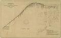
City of Seattle Harbor Department Map of Central Waterfront District, August 1916
Maritime trade was crucial to the city's economic development, and Seattle continues to be defined and supported by the harbor that has become one of the busiest ports in the U. S. This 1916 map of Elliott Bay depicts wharves and businesses along the waterfront, as well as and water depths (soundings) along piers and in Elliott Bay. Each street,…
ID Number:2019.3.17
Date:1916
Cartographic material
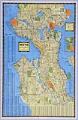
Seattle, Washington, circa 1938
In 1903 Carl Albert Kroll (1882-1982) immigrated from Germany to the U. S., finding work as a drafting technician at the Moran Brothers shipbuilding company. By 1910 Kroll was the manager at O. P. Anderson Map & Blue Print Company. The following year he acquired both the Anderson Map Company and the Washington Map and Blueprint Company to form the…
ID Number:2019.3.18
Date:Circa 1938
Cartographic material
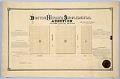
Boston Heights Supplemental Addition to the City of Seattle, February 25, 1890
Thomas Rock (1846-1908) immigrated to the U. S. from Ireland about 1870. By 1877 he was living in Seattle, and married another Irish immigrant, Mary Ann (Graham) Rock (1853-1932), and started a family. The Rocks owned property in Seattle, probably from a donation land claim granted by the U. S. government, that was platted as the Boston Heights Supplemental Addition…
ID Number:2019.3.20
Date:1890
Cartographic material
Condemnation of Lane Street et al Establishing Grades map, Seattle, July 1916
Starting in 1897 and continuing through 1930, the topography of central Seattle was radically altered by a series of regrades. An estimated 50 tons of earth removed from the city's hills were moved into the tide flats and other low areas, and into Elliott Bay.In June 1916, a bill was passed for the condemnation of property for changing and establishing…
ID Number:2019.3.21
Date:1916
Cartographic material
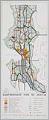
Comprehensive plan of Seattle, September 1956
In the late 1940s, Seattle’s City Planning Commission began work on a comprehensive plan for the city in order to plan its future development and growth. The results, in the form of a map, were presented to the mayor in October 1956 and accepted in principle by the City Council in April 1957. The plan had three major parts: land…
ID Number:2019.3.26
Date:1956
Cartographic material
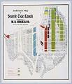
Anderson's Map of Seattle Tide Lands, circa 1907
Martin Burdett Crane (1872-1954) came to Seattle in 1892, after time in Alaska searching for gold and piloting boats. For several years he worked between Alaska and Seattle, and as early as 1898, M. B. Crane & Co. of Seattle and Dawson City was advertising in the Seattle Daily Times offering claims in the Klondike District. Crane married Seattle native…
ID Number:2019.3.28
Date:Circa 1907
Cartographic material
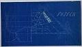
Foster, Washington, plat map, circa 1905
This blueprint map depicts the former King County community of Foster, Washington, just south of Seattle city limits. Brothers Joseph and Stephen Foster came from Illinois and settled in the area in 1852, where the Black and White Rivers met. Joseph Foster became a very prominent pioneer who served as an early Washington Territorial legislator, the first superintendent of schools,…
ID Number:2019.3.30
Date:Circa 1905

Poster
Coliseum Theatre film poster, Seattle, June 10-19, 1922
Seattle's Coliseum Theatre, at the northeast corner of Fifth Avenue and Pike Street, was the world's first theater designed just for the movies. Unlike other theaters of its time, it had no stage for live acts. It did, however, have a nursery for children, and an organ and orchestra to play with silent movies. Designed by B. Marcus Priteca (1889-1971),…
ID Number:2019.3.34
Date:1922