1868 results for: Seattle Times
Ephemera
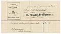
Subscription receipt for Weekly Intelligencer, January 30, 1873
Seattle's oldest newspaper, The Seattle Post-Intelligencer, was founded in 1863 as The Weekly Intelligencer (also known as Seattle Gazette), when the city of Seattle was little more than a sawmill, a few dozen buildings, and a couple of hundred people. In 1881, The Intelligencer merged with The Seattle Post and moved into the newly completed Post building, on the northeast…
ID Number:2018.3.3.94
Date:1973
Program
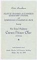
Luncheon program for Crown Prince Olav's visit, 1939
From May 23-28, 1939, Norway's Crown Prince Olav (1903-1991) and his wife, Princess Martha (1901-1954), visited Washington State during a West Coast tour on the eve of World War II. Among other activities, they spent a day skiing at Paradise on Mount Rainier and attended the dedication of the Stanwood monument honoring the first Norwegian settler on Puget Sound, Zakarias…
ID Number:2018.3.3.97
Date:1939
Program
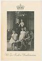
Event program for Crown Prince Olav's visit, 1939
From May 23-28, 1939, Norway's Crown Prince Olav (1903-1991) and his wife, Princess Martha (1901-1954), visited Washington State during a West Coast tour on the eve of World War II. Among other activities, they spent a day skiing at Paradise on Mount Rainier and attended the dedication of the Stanwood monument honoring the first Norwegian settler on Puget Sound, Zakarias…
ID Number:2018.3.3.98
Date:1939
Program
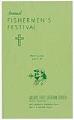
Fishermen's Festival program, March 19, 1950
Seattle's annual Fishermen's Festival was first held in 1929, hosted by Reverend Olai Ludvig Haavik (1886-1977), minister at Ballard First Lutheran Church from 1921-1947. Initially a simple gathering of fishermen and their families to receive the blessing of the church for a safe and successful voyage north and to give thanks for the past years' harvests, the festival evolved to…
ID Number:2018.3.3.99
Date:1950
Ephemera
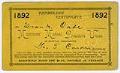
Musicians' Mutual Protective Union of Seattle membership card, June 17, 1892
Frank Buell Cade (1868-1954) came to Seattle in 1890, the same year that saw the creation of the Seattle chapter of the Musicians Mutual Protective Union (MMPU), Local 30 of the National League of Musicians (NLM) (later AFM Local 76, now AFM Local 76-493). Mr. Cade began working as a bookkeeper for the People & Knowles Sheet Metal Works (he…
ID Number:2018.3.3.105
Date:1892
Ephemera
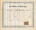
Marriage certificate of Amos Brown and Annie Peebles, November 5, 1867
Seattle's population had more than doubled in the decade since the first families founded the city in 1852, however the population largely consisted of young bachelor men who came to work in the timber and fishing industries. In the early 1860s Asa Shinn Mercer (1839-1917), first president of the Territorial University of Washington (now University of Washington) and its only…
ID Number:2018.3.3.106
Date:1867
Ephemera
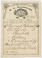
Seattle Drug Store prescription, circa 1880
Moses Rideout Maddocks (1833-1919) arrived in Washington Territory in 1858, where he worked as a logger and was elected to the state legislature (he later served as Seattle's fourth mayor). He came to Seattle permanently in 1864, and about two years later became part owner of a drug store. He bought out his partner after 18 months and solely operated…
ID Number:2018.3.3.111
Date:Circa 1880
Document
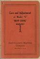
Care and Adjustment of Model "G" "Iron Chink," circa 1906
In 1903, Seattle inventor Edmund A. Smith (1870-1909) developed a machine that gutted and cleaned salmon for canning 55 times faster than human workers. Most Northwest cannery workers were Chinese immigrants, and Smith, with "unselfconscious racism" (in the words of historian Carlos Schwantes), called his invention the "Iron Chink." The innovation increased cannery profits, but forced thousands of people to…
ID Number:2018.3.3.128
Date:Circa 1906
Ephemera
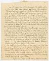
Handwritten statement by Annie Peebles Brown and Elizabeth Peebles MacKintosh, circa 1900
Seattle's population had more than doubled in the decade since the first families founded the city in 1852, however the population largely consisted of young bachelor men who came to work in the timber and fishing industries. In the early 1860s Asa Shinn Mercer (1839-1917) decided to go to the east coast to find educated, marriageable women of good moral…
ID Number:2018.3.3.133
Date:Circa 1900
Ephemera
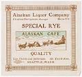
Alaskan Liquor Company advertisement, circa 1912
The Alaskan Cafe was opened on July 1, 1909, in the Arctic Club building at the corner of Third and Jefferson in Seattle, by owners Charles Berryman and Ludovico Dallagiovanna. The image of a dog sled found in the center of the ad shown here is from stained glass piece hung over the entrance to the barroom at the Alaskan…
ID Number:2018.3.3.139
Date:Circa 1912