157 results for: Aerial Views
Photograph
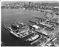
Aerial view looking northeasterly, Todd Pacific Shipyards Corp, Seattle Division, 1977
The Seattle Division of Todd Shipyard Corporation originated in 1916, when the William H. Todd Corporation purchased the Seattle Construction and Dry Dock Company (formerly Moran Brothers Shipyard). Originally located on the Seattle waterfront, the shipyard built cargo vessels for the U.S. Shipping Board during World War I. Todd moved the operation to a new plant on Harbor Island in…
ID Number:2023.36.70
Date:1977
Photograph
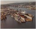
Aerial view of yard looking southwesterly, Todd Pacific Shipyards Corp, Seattle Division, 1983
The Seattle Division of Todd Shipyard Corporation originated in 1916, when the William H. Todd Corporation purchased the Seattle Construction and Dry Dock Company (formerly Moran Brothers Shipyard). Originally located on the Seattle waterfront, the shipyard built cargo vessels for the U.S. Shipping Board during World War I. Todd moved the operation to a new plant on Harbor Island in…
ID Number:2023.36.71
Date:1983
Photograph
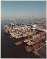
Aerial view looking northeasterly, Todd Pacific Shipyards Corp, Seattle Division, 1983
The Seattle Division of Todd Shipyard Corporation originated in 1916, when the William H. Todd Corporation purchased the Seattle Construction and Dry Dock Company (formerly Moran Brothers Shipyard). Originally located on the Seattle waterfront, the shipyard built cargo vessels for the U.S. Shipping Board during World War I. Todd moved the operation to a new plant on Harbor Island in…
ID Number:2023.36.72
Date:1983
Photograph
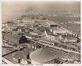
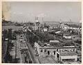
Aerial view of the Associated Shipbuilders shipyard, Seattle, April 22, 1941
Founded in 1889, the Puget Sound Bridge and Dredging Company was also called Puget Sound Bridge and Drydock, Associated Shipbuilders, and Lockheed Shipbuilding and Construction Company. The company participated in most major construction sites in the Pacific Northwest, and they are responsible for many ships, including some of the Washington State ferries and many naval vessels during and after World…
ID Number:Lib1988.13.4.2c.2
Date:1941
Photograph
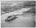
Aerial view of the Associated Shipbuilders shipyard, Seattle, November 1943
Founded in 1889, the Puget Sound Bridge and Dredging Company was also called Puget Sound Bridge and Drydock, Associated Shipbuilders, and Lockheed Shipbuilding and Construction Company. The company participated in most major construction sites in the Pacific Northwest, and they are responsible for many ships, including some of the Washington State ferries and many naval vessels during and after World…
ID Number:Lib1988.13.4.2d.1
Date:1943
Photograph
Aerial view of the Associated Shipbuilders shipyard, Seattle, June 14, 1955
Founded in 1889, the Puget Sound Bridge and Dredging Company was also called Puget Sound Bridge and Drydock, Associated Shipbuilders, and Lockheed Shipbuilding and Construction Company. The company participated in most major construction sites in the Pacific Northwest, and they are responsible for many ships, including some of the Washington State ferries and many naval vessels during and after World…
ID Number:Lib1988.13.4.2f.4
Date:1955
Photograph
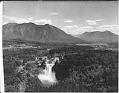
Aerial of Snoqualmie Falls, near Snoqualmie, circa 1965
The Snoqualmie River drops 268 feet at Snoqualmie Falls. The waterfall was spiritually important to the Snoqualmie people who once lived in the area and was a scenic wonder to the settlers who came later. After the Seattle, Lake Shore and Eastern Railway was built along the south shore in 1889, the falls became a popular place for day trips…
ID Number:Lib1993.20.333
Date:Circa 1965
Photograph
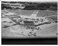
Aerial view of Sea-Tac Airport on opening day, July 9, 1949
In 1942, construction started on a new international airport between Seattle and Tacoma. The new airport, dubbed Sea-Tac, was formally dedicated on July 9, 1949. The airport cost $11 milliion and opened free of debt. United Airlines, Northwest Airlines, Pan American World Airways and Western Airlines started their regular passenger service at Sea-Tac on the day of the dedication.This July…
ID Number:PI20340
Date:1949
Photograph
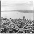
Aerial of Evergreen Point Bridge under construction from southwest, Seattle, 1963
Washington's Evergreen Point Floating Bridge carries State Route 520 across Lake Washington, connecting Seattle with the growing area east of the lake. When it opened, the bridge's 7,578 foot floating span was the longest in the world. This was the second floating bridge to cross Lake Washington, and both bridges are overcrowded daily with commuters in their automobiles.This photo shows…
ID Number:PI20474
Date:1963
Photograph
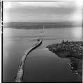
Aerial view of Evergreen Point Floating Bridge, March 1963
Washington's Evergreen Point Floating Bridge carries State Route 520 across Lake Washington, connecting Seattle with the growing area east of the lake. When it opened, the bridge's 7,578 foot floating span was the longest in the world. This was the second floating bridge to cross Lake Washington, and both bridges are overcrowded daily with commuters in their automobiles.//This photo shows…
ID Number:PI20478
Date:1963