153 results for: Aerospace
Photograph
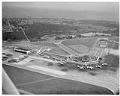
Aerial view of Seattle-Tacoma International Airport, March 7, 1959
On March 7, 1942, three months after Japan attacked Pearl Harbor, the Port of Seattle undertook development of Seattle-Tacoma International Airport at the urging of the federal government. A new airport was desperately needed to help relieve pressure on Seattle’s Boeing Field and Tacoma’s McChord Field, which were commandeered for warplane production and military use in World War II. Sea-Tac’s…
ID Number:2009.23.21
Date:1959
Photograph
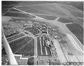
Aerial view of Seattle-Tacoma International Airport, May 8, 1959
On March 7, 1942, three months after Japan attacked Pearl Harbor, the Port of Seattle undertook development of Seattle-Tacoma International Airport at the urging of the federal government. A new airport was desperately needed to help relieve pressure on Seattle’s Boeing Field and Tacoma’s McChord Field, which were commandeered for warplane production and military use in World War II. Sea-Tac’s…
ID Number:2009.23.23
Date:1959
Menu
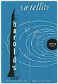
Harold's Satellite restaurant and Galaxy Room menu, circa 1965
Harold's Satellite restaurant and Galaxy Room was located at 2501 Fairview Avenue East on the shores of Lake Union. Harold's was owned by Harold C. and Evelynne F. Frye. The menu, which has a space theme with rockets and astronaut cartoons, includes information on the back about Boeing's orginal lakeside hangar which was located north of the restaurant. Harold's also…
ID Number:2014.3.1.11
Date:Circa 1965
Menu
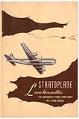
Stratoplane Luncheonettes menu, 1943
The Stratoplane Luncheonettes was located at 1617 3rd Ave. The name refers to the Boeing Stratoliner, a four-engine airliner introduced in the late 1930s. Pictured on the menu's cover, this plane could undertake long distance international flights. The back cover features ads for Mello-Cup Coffee, Royal Dutch dairy products, Butter Krisp bakery products, Olympic Pies, and seafood furnished fresh daily…
ID Number:2014.3.1.29
Date:1943
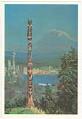
Menu
United Airlines menu, circa 1980
The cover of this United Airlines menu features a view of Seattle highlights painted by artist Peter Hayward, showing the Space Needle, Mt. Rainier, a totem pole, and fir trees.
ID Number:2014.3.1.67
Date:Circa 1980
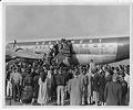
Photograph
Northwest Airlines plane with passengers on the boarding ramp, Seattle, circa 1950
A Northwest Airlines plane, possibly a Boeing 377 Stratocruiser at Seattle-Tacoma International Airport, is on the runway with a big crowd at the boarding ramp. On the lower part of the ramp, an African-American man looks back towards the camera and waves his hat. The original print is slightly out of focus.
ID Number:2014.49.Box22.Folder20.002
Date:Circa 1953
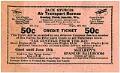
Ephemera
Jack Sturgis Air Transport Bureau ticket, circa 1930
This ticket offers a 50¢ credit to be used at any aviation company that is a member of the Jack Sturgis Air Transport Bureau. The bureau was run out of the Municipal Airport (also known as Boeing Field) in Seattle's Georgetown neighborhood. Services offered ranged from passenger tickets to Portland, San Francisco, and Los Angeles, to aerial tours over downtown…
ID Number:2018.3.3.24
Date:Circa 1930
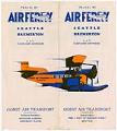
Ephemera
Gorst Air Transport Air Ferry brochure, circa 1928
Vernon C. Gorst, who previously had founded Pacific Air Transport in 1926, (which provided the first airmail service between Los Angeles and Seattle), established Gorst Air Transport, Inc., sometime in the late 1920s. In addition to providing hourly commuter flights for passengers, the air service carried parcels, letters and small packages. This leaflet advertises Gorst's "Air Ferry" service, a 12-minute…
ID Number:2018.3.3.26
Date:Circa 1928
Program
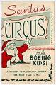
Boeing Children's Christmas Party program, 1953
The workforce and economy of Seattle from WWII through the 1970s was largely dependent on the Boeing Company and the commercial-airplane market. In 1957 business was booming due to the rise of the jet airplane. At the time Boeing employed about 100,000 people, including half of King County's manufacturing workers, while the Seattle's total population was only 550,000. This program…
ID Number:2018.3.3.31
Date:1953
Music, notated
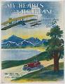
My Heart's in the Aeroplane
“My Heart’s in the Aeroplane” was published in 1911, some eight years after the Wright Brothers made their first flight. The subtitle, “The Latest Air Ship Love Song Success”, implies that this new topic was a popular one. The sheet music cover shows two men flying a fragile airplane, watched from below by a couple in a car. The setting,…
ID Number:2018.3.2.10
Date:1911