7 results for: City of Seattle, Harbor Department
Ephemera
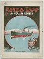
Ames Log, Issue 21, November 24, 1919
St. Louis native Edgar Ames (1868-1944) moved to Seattle from Chicago in 1895 and in 1916 founded the Ames Shipbuilding & Drydock Company in Seattle. The modern plant he built on Harbor Island covered 20 acres and included a floating drydock. During World War I the yard produced 25 steel tankers and cargo steamships for the U.S. Shipping Board, and…
ID Number:1981.7373.1
Date:1919
Photograph
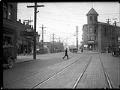
View along Ballard Avenue with City Hall building, Seattle, October 19, 1925
The cornerstone for Ballard's city hall was laid in May 1899, and the building was completed about nine years later, about the same time that Ballard was incorporated as part of Seattle. The building housed a jail, city offices, the fire department, community meeting rooms, a ballroom, and later, a police precinct. This view shows automobiles parked in front of…
ID Number:1983.10.12223.1
Date:1925
Photograph
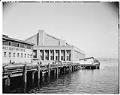
South side of US Naval Reserve Armory, Lake Union, August 22, 1942
Built on the former site of a Duwamish village, the Naval Reserve Armory was announced in 1937 but trouble with funding delayed completion of the project for several years. The Armory was designed by well-known theater architect B. Marcus Priteca and William R. Grant. The Works Progress Administration, one of the New Deal agencies, constructed the building. Groundbreaking occurred in…
ID Number:1983.10.17273.3
Date:1942
Audio recording
Oral history interview with Edith Robertson, January 6, 1985
Edith Robertson was born in Kansas City. She moved to Spokane in the early 1930s and Seattle in 1933. She worked as a waitress and a beautician before going to work in the shipyards during World War II. In this interview conducted by Lorraine McConaghy for the Life on the Homefront Oral History Project on January 6, 1985, Robertson recalls…
ID Number:1985.134.20
Date:1985
Cartographic material
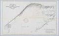
The City of Seattle Harbor Department Map of Central Waterfront District, February 1918
Maritime trade was crucial to the city's economic development, and Seattle continues to be defined and supported by the harbor that has become one of the busiest ports in the U. S. This 1918 map of Elliott Bay depicts wharves and businesses along the waterfront, as well as and water depths (soundings) along piers and in Elliott Bay. Each street,…
ID Number:2000.87.34
Date:1918
Cartographic material
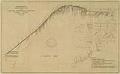
City of Seattle Harbor Department Map of Central Waterfront District, August 1916
Maritime trade was crucial to the city's economic development, and Seattle continues to be defined and supported by the harbor that has become one of the busiest ports in the U. S. This 1916 map of Elliott Bay depicts wharves and businesses along the waterfront, as well as and water depths (soundings) along piers and in Elliott Bay. Each street,…
ID Number:2019.3.17
Date:1916
Cartographic material
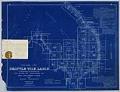
Seattle Tide Lands, Volume Two, index, 1894-1896
Seattle in the late nineteenth century was a rapidly growing city, aided in no small part by the 1883 connection to the rest of the country by the Northern Pacific Railway Company (NPRR). Additionally, the city's population doubled in 1890 from the previous year to 40,000, boosted by the influx of people who saw opportunity in rebuilding after Seattle's Great…
ID Number:2019.3.23.1
Date:1894-1895