Back to Results
2019.3.46
View full size image or right-click on image to save
Cartographic material
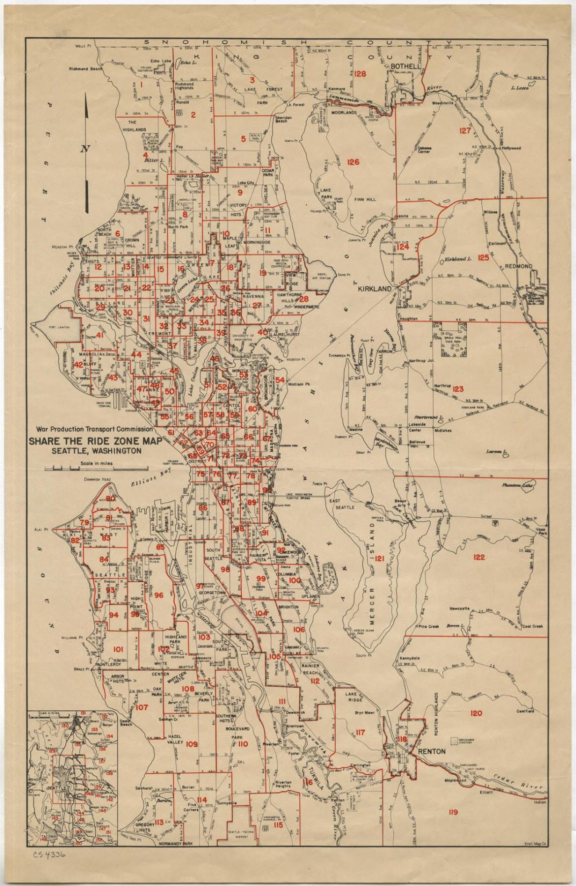
Share the Ride Zone Map, Seattle, 1942
Order an ImageIn 1942, during World War II, the federal government’s War Production Transport Commission mandated that citizens cut back on the use of gasoline and rubber tires for the war effort. Seattle and other cities developed city-wide carpooling plans. Businesses and neighborhoods formally registered share-the-ride groups, and members were eligible for additional gasoline stamps once rationing began. By the fall of 1942, Seattle had one of the heaviest participation rates in the nation.
This map from the War Production Transport Commission was published by Seattle’s Kroll Map Company. It shows the various “share-the-ride” zones in Seattle and King County.
Caption information source: The Seattle Times: June 7, 1942, p. 15; August 27, 1942, p. 5; October 26, 1942, p. 15; November 1, 1942, p. 38.
This map from the War Production Transport Commission was published by Seattle’s Kroll Map Company. It shows the various “share-the-ride” zones in Seattle and King County.
Caption information source: The Seattle Times: June 7, 1942, p. 15; August 27, 1942, p. 5; October 26, 1942, p. 15; November 1, 1942, p. 38.
ID Number: 2019.3.46
Date: 1942
Creator(s):
Kroll Map Company, Inc., Publisher
Physical Description: 1 map : color ; 11 x 17 in.
Additional Information: Digital copy of this item available thanks to funding from a 2016 Institute for Museum and Library Services grant.
Credit: MOHAI, 2019.3.46
Copyright: All Rights Reserved
Other matching results
Gracie Fields benefit concert program, January 24, 1941
War Bond envelope, circa 1942
Stamp Out the Axis war savings stamp album, circa 1943
Application for home canning sugar allowance, 1944
Leaflet on war-time telephone calls, July 1942
Hotel Frye air raid blackout notice, circa 1943
Letter from Francis Clowers about donating to the War & Community Chest campaign, Seattle, October 25, 1945