Back to Results
2019.3.26
View full size image or right-click on image to save
Cartographic material
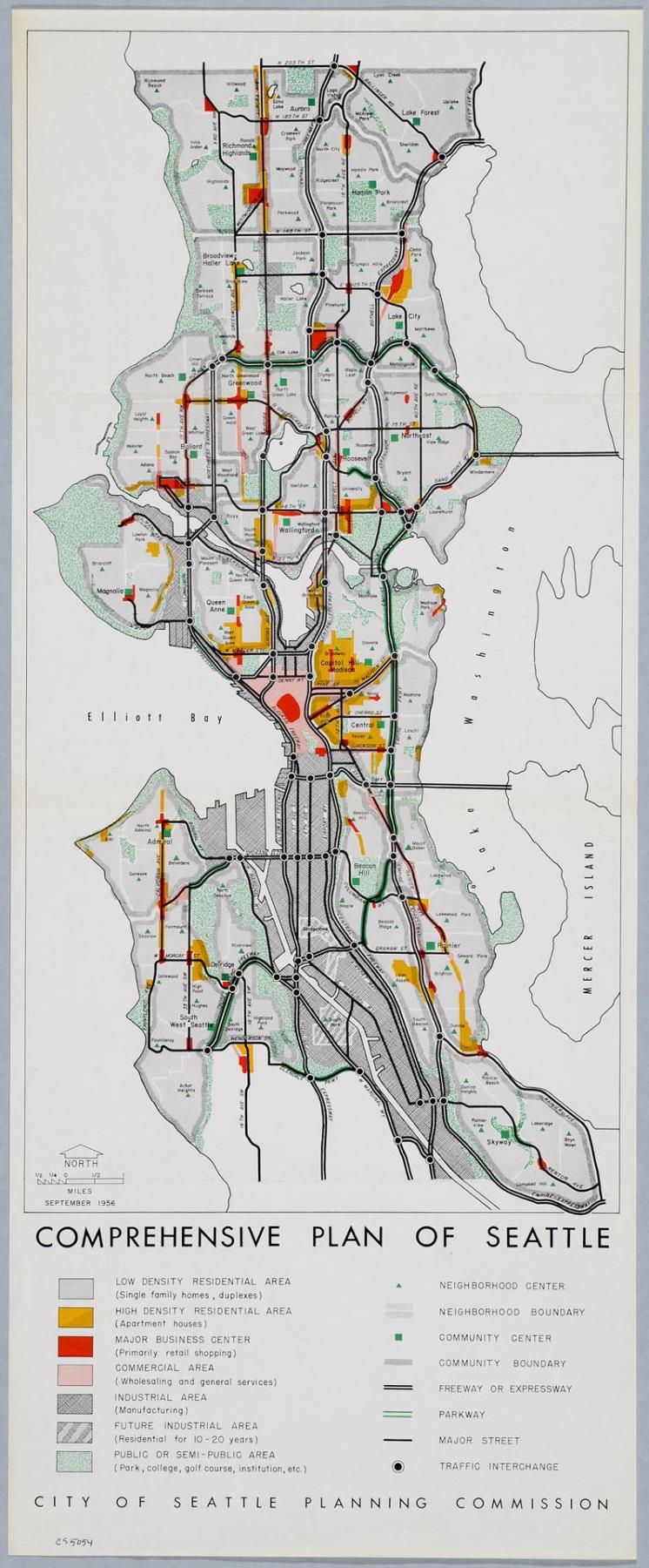
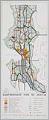
Comprehensive plan of Seattle, September 1956
Order an ImageIn the late 1940s, Seattle’s City Planning Commission began work on a comprehensive plan for the city in order to plan its future development and growth. The results, in the form of a map, were presented to the mayor in October 1956 and accepted in principle by the City Council in April 1957. The plan had three major parts: land use, arterial routes and community/neighborhood development. Zoning laws were to be based on the plan.
This September 1956 comprehensive plan map shows projected low and high density residential areas; business, commercial, and industrial areas; parks and other public areas; planned arterials and freeways; and other aspects of Seattle’s projected future development.
Caption information source: The Seattle Daily Times: October 31 1956, p. 14 ; and April 30, 1957, p. 11.
Caption information source: The Seattle Sunday Times: August 25, 1957, pp. 104-105 (consulted online). Originally The Seattle Sunday Times Magazine, pp. 13 and 14.
This September 1956 comprehensive plan map shows projected low and high density residential areas; business, commercial, and industrial areas; parks and other public areas; planned arterials and freeways; and other aspects of Seattle’s projected future development.
Caption information source: The Seattle Daily Times: October 31 1956, p. 14 ; and April 30, 1957, p. 11.
Caption information source: The Seattle Sunday Times: August 25, 1957, pp. 104-105 (consulted online). Originally The Seattle Sunday Times Magazine, pp. 13 and 14.
ID Number: 2019.3.26
Date: 1956
Creator(s):
Seattle City Planning Commission, Publisher
Physical Description: 1 map : color ; 11 x 27 in.
Additional Information: Digital copy of this item available thanks to funding from a 2016 Institute for Museum and Library Services grant.
Credit: MOHAI, 2019.3.26
Copyright: All Rights Reserved
Subjects:
Construction and Urban Planning
Other matching results
View underneath the Alaskan Way viaduct at South Main Street and Alaskan Way, Seattle, May 2010
"Don't be deceived by the down town landlords" leaflet, 1912
Denny Clay Company receipt, December 6, 1893
Map of Harbor Island and Duwamish waterway districts, Bogue map, No. 7, September 1911
Open Space Proposed Zoning Map, Seattle, December 1985
Comprehensive plan of Seattle, September 1956
Seattle Commons Draft Plan poster, 1992
Birdseye View of Lake Forest Park and Seattle, 1910
Building Trades Day for the United War Chest poster, 1942