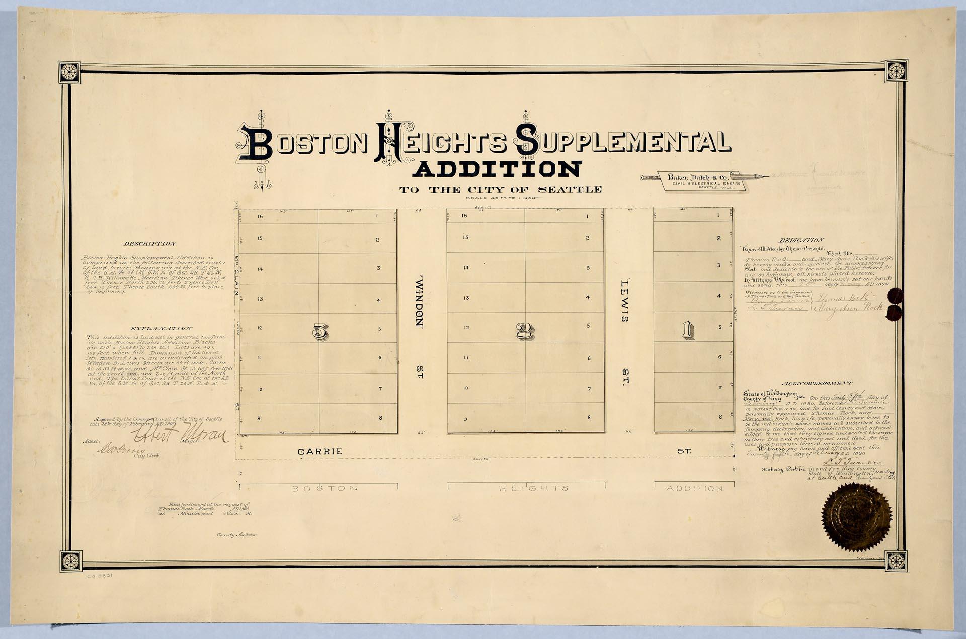
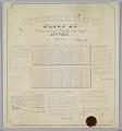
Thomas Rock (1846-1908) immigrated to the U. S. from Ireland about 1870. By 1877 he was living in Seattle, and married another Irish immigrant, Mary Ann (Graham) Rock (1853-1932), and started a family. The Rocks owned property in Seattle, probably from a donation land claim granted by the U. S. government, that was platted as the Boston Heights Supplemental Addition to the City of Seattle. The land was bordered on the south by Carrie Street (now East Thomas Street) and contained Windon and Lewis Streets (now Twenty-third Avenue), placing the land in the area today known as the Stevens neighborhood, on the east side of Capitol Hill.
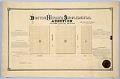
In 1890 Thomas and Mary Ann Rock had the plat map pictured here notarized and filed with Seattle's City Council. The map describes their land, and gives the city the right to public use of the streets on their land. Both Thomas and Mary Ann signed the document, as well as notary public L. T. Turner, and Mayor Robert Moran (1857-1943).
Handwritten on verso: Thomas Rock, March 3, 1890, 31 min past 11 a.m., recorded in Volume V, Plats 17. Robert A. Rock, 1103 East Republican. FR 1308.
Caption information source: "Rock Funeral Announced," The Seattle Daily Times, June 18, 1908, p. 13. Caption information source: from http://ba-kground.com/1895-seattle-street-renaming-searchable-table