Since the beginning of the twentieth century, the City of Seattle showed interest in purposefully growing the city. In 1903 the city contracted the Olmsted Brothers to create a comprehensive Seattle park and boulevard system, and in 1910 hired Virgil G. Bogue to prepare a strategic plan. The Seattle Zoning Commission was created in 1920 to divide the city into zones or districts and specify uses for property in each zone, and successfully passed its first zoning ordinance in 1923. The mid-twentieth century saw a movement away from the city center towards suburban developments, but in the late 1960s and early 1970s the city began to explore regional development and urban renewal spearheaded by movements like environmental protection and historic preservation.
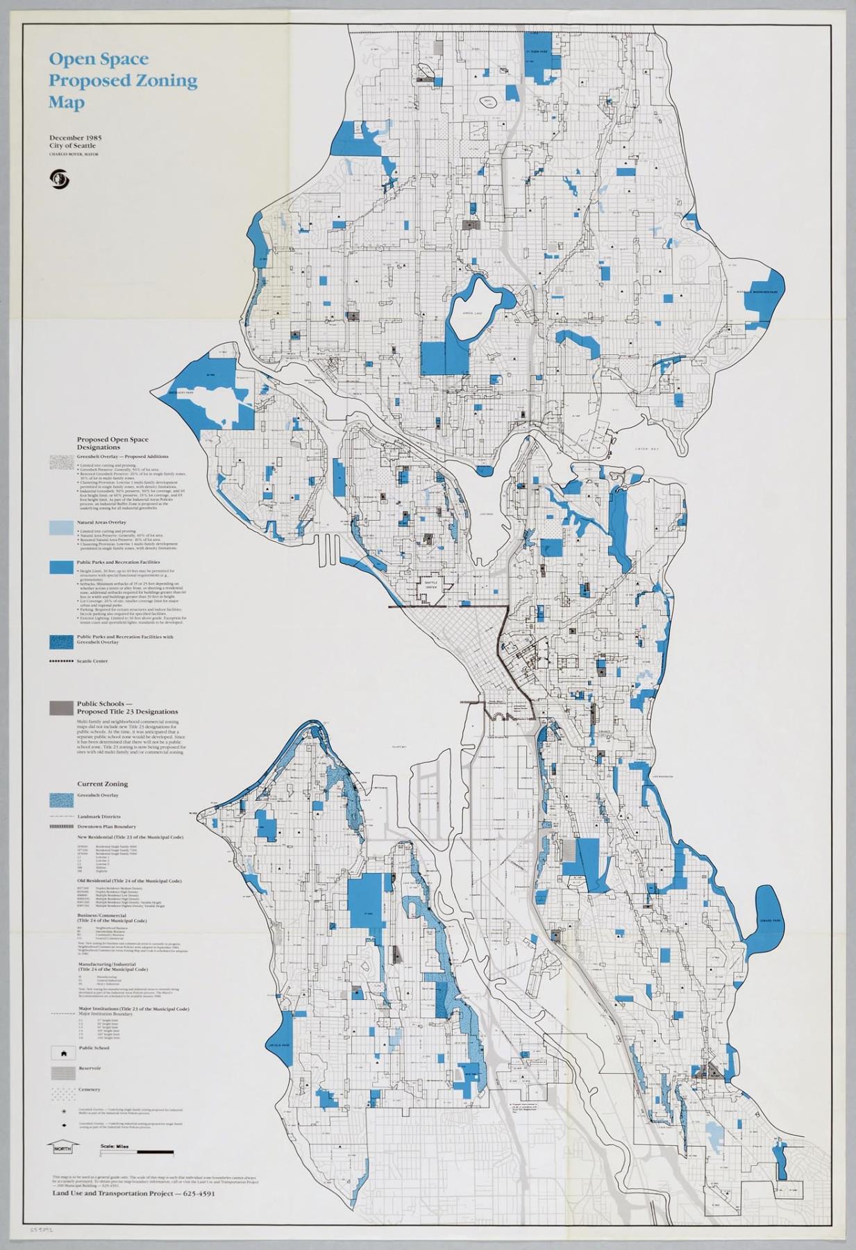
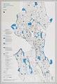
Seattle's Land Use and Transportation Project created this map of proposed open spaces zoning in 1985, highlighting current types of zoned land, with proposed open space designations in natural areas, parks and recreation facilities, and additional greenbelts.
Text on map: Open Space Proposed Zoning Map, December 1985, City of Seattle, Charles Royer, Mayor
Caption information source: "Introduction to Seattle Planning and Development History," by Dennis Meier and John Skelton, Seattle City Planning, http://www.seattle.gov/dpd/AppDocs/GroupMeetings/DCPresentation1History-of-Seattle-City-PlanningAgendaID2973.pdf