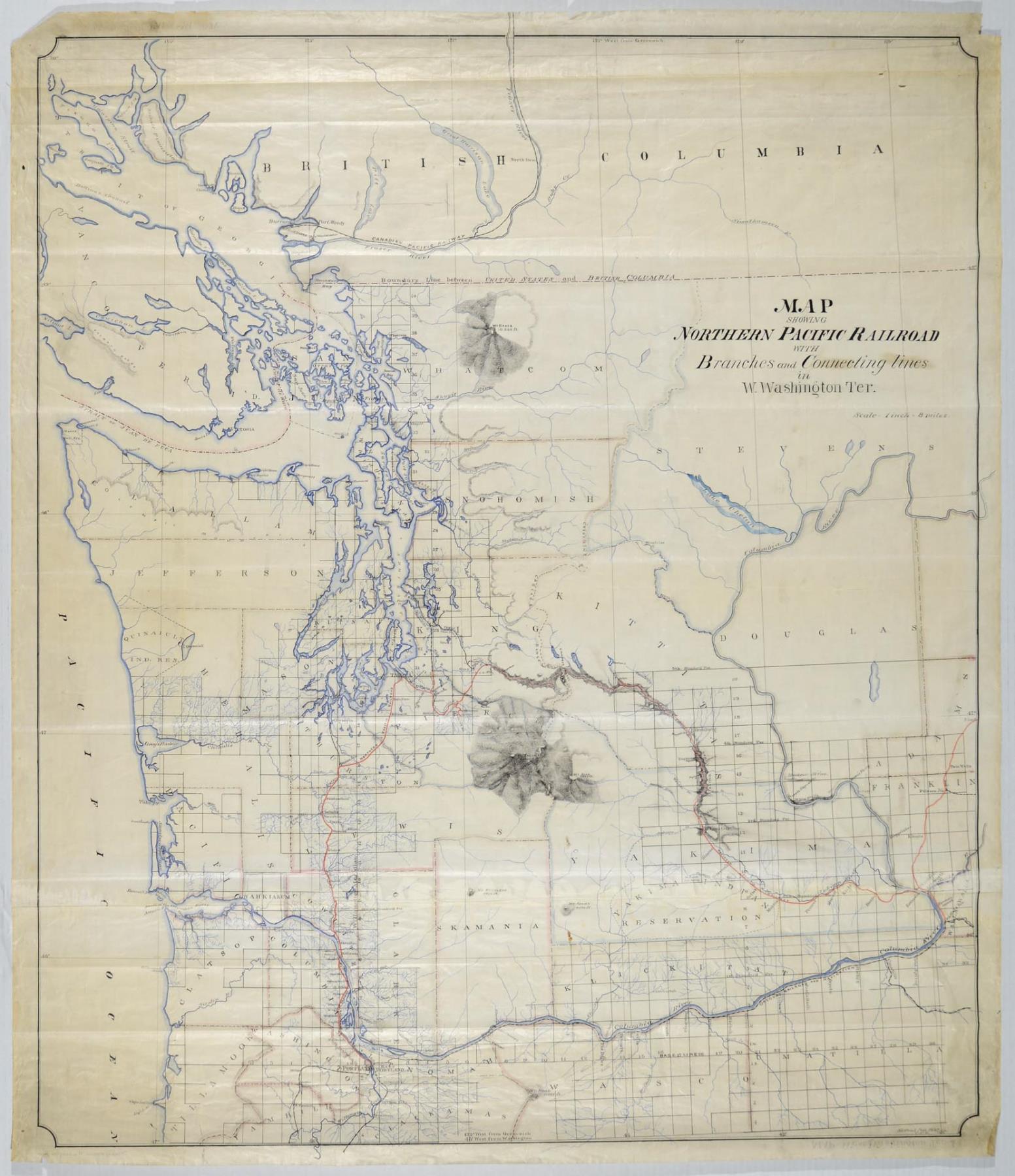
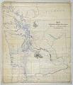
The Northern Pacific Railway was chartered by the U. S. Congress in 1864 with the goals of connecting the Great Lakes with Puget Sound, and linking Oregon and Washington with the rest of the country. This map of the Northern Pacific Railroad and connecting lines covers an area from the south of Portland and the Columbia River well into British Columbia. The Northern Pacific line is shown in red, originating in the south at Kalama, Washington Territory, outside Portland, and running north to its terminus in Tacoma before heading east across the Cascades. Two shades of blue are used to indicate rivers, coastlines, and tributary streams, and light pink shows county lines.
Text on map: Map Showing Northern Pacific Railroad with Branches and Connecting Line in Washington Terr. Scale - 1 inch = 8 miles Signed on bottom: St. Paul // Jan 17 87 // C.F.H.
ID Number: 2015.60.1
Date: 1887
Physical Description: 1 map : color ; 38.5 x 44.75 in.
Additional Information: Digital copy of this item available thanks to funding from a 2016 Institute for Museum and Library Services grant.