Since the city's earliest days, Seattleites proposed canals to cheaply and easily move logs, coal, and other resources between Elliott Bay and Lake Washington. Possible routes extended from the Black River at the south end of Lake Washington to canals through Lake Union and Shilshole Bay in the north. A 1891 report commissioned by the federal government explored five possible routes, two of which included Salmon Bay between Ballard and Seattle. The route chosen was proposed in 1907 and connected two canals, the Fremont Cut between Salmon Bay and Lake Union and the Montlake Cut between Lake Union and Lake Washington, with locks at Salmon Bay. The Lake Washington Ship Canal was completed in 1917.
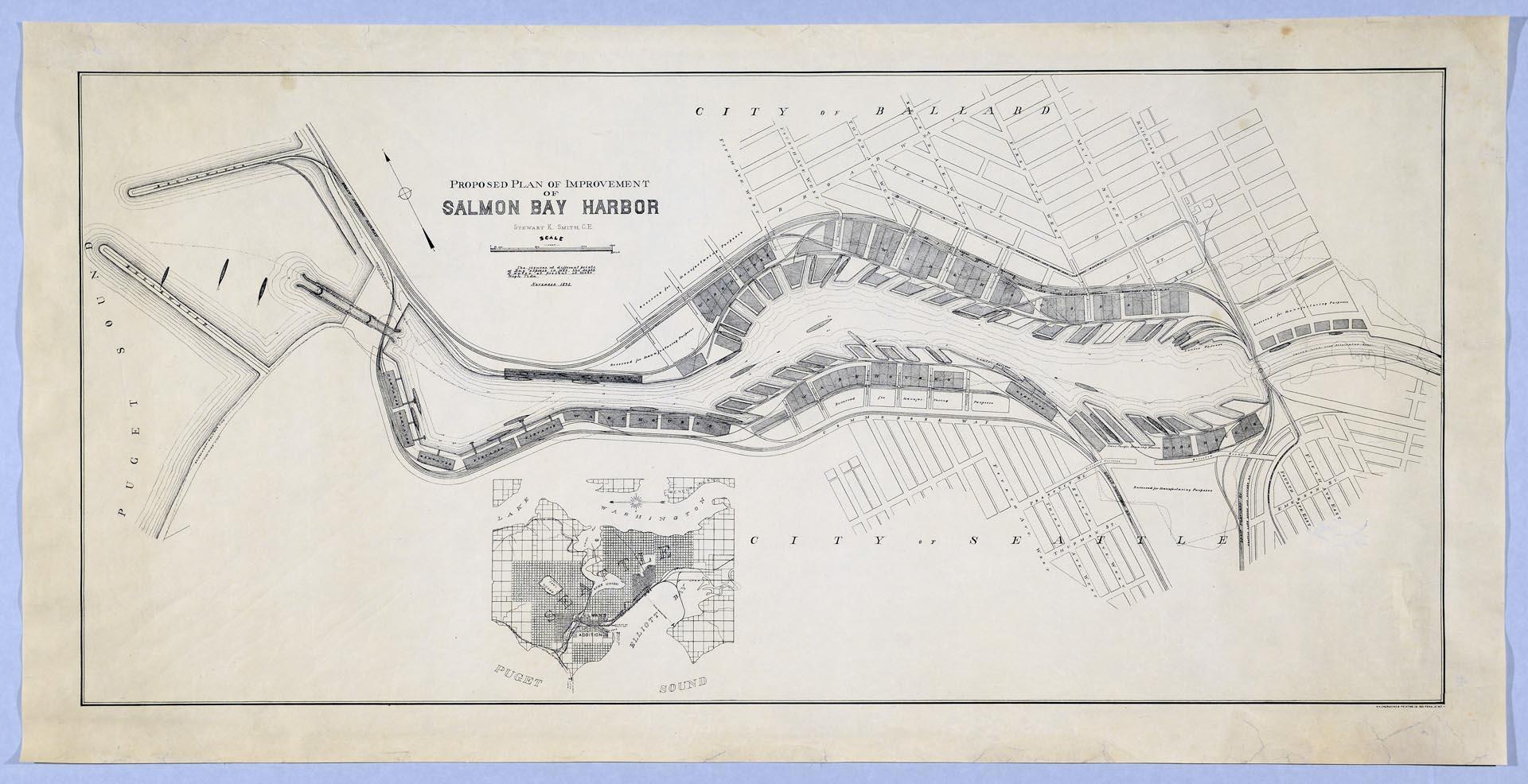
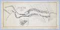
This proposed plan for Salmon Bay Harbor from 1892 was likely associated with the federal report named above. The map extends from the mouth of Puget Sound in the west to just east of the Seattle, Lake Shore, and Eastern Railway bridge across the bay, highlighting both existing transportation routes and wharves along with suggestions for the canal and locks, with manufacturing land and possible warehouses mentioned at the waterway.
Text on map: Proposed Plan of Improvement of Salmon Bay Harbor, Stewart K. Smith, C. E., The figures at different points of Bay express in feet, the depth of water at present at Moan [sic] High Tide, November 1892. N. Y. Engraving & Printing Co., 328 Pearl St, N. Y.
Caption information source: "Lake Washington Ship Canal (Seattle)," by David B. Williams, HistoryLink.org Essay 1444, https://www.historylink.org/File/1444.
Physical Description: 1 map : b&w ; 39.75 x 20 in.
Additional Information: Digital copy of this item available thanks to funding from a 2016 Institute for Museum and Library Services grant. View the finding aid for this collection at https://archiveswest.orbiscascade.org/ark:80444/xv40124
Credit: MOHAI, Robert Roblee Collection of William N. Bell Family Materials, 2008.54.48