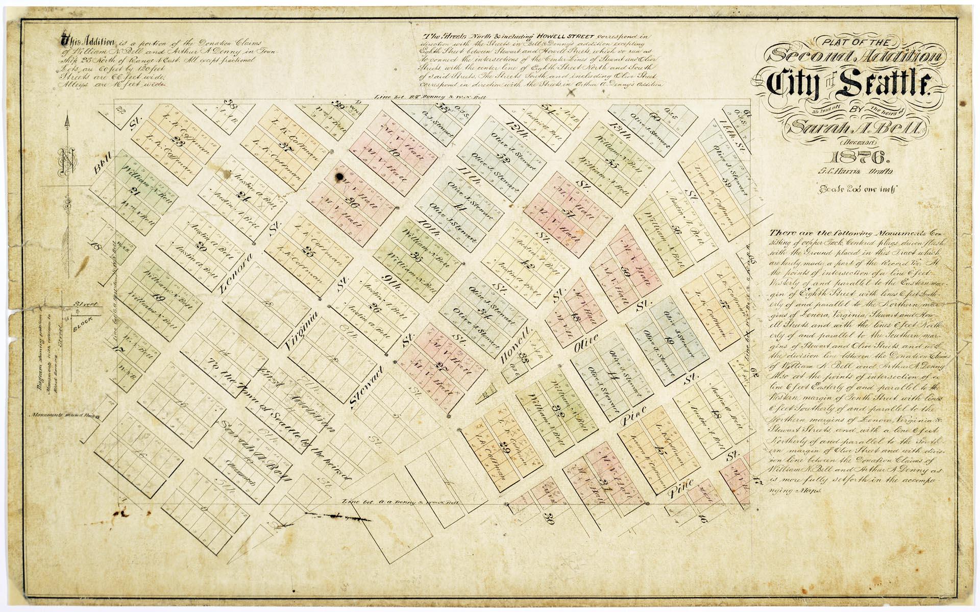
Seattle pioneers William Nathaniel Bell (1817-1887) and his wife, Sarah Ann (Peter) Bell (1819-1856), were members of the Denny Party, arriving in present-day West Seattle in 1851. The Bells helped to establish the settlement that became Seattle, settling north of the future downtown in "Belltown." Denny party leaders Arthur Armstrong Denny (1822-1899) and his wife Mary Ann Boren Denny (1822-1910) were granted original land claim donations by the U. S. Government on property south of the Bell's, with Olive Street as the dividing line between the two.
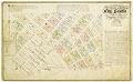
The plat map pictured here shows the Second Addition to the City of Seattle, made up of sections of the original donation land claims granted to William N. Bell and Arthur A. Denny. This map would have been prepared and submitted for recording by the King County Auditor (now King County Recorder's Office) as an official representation of the addition's boundary lines, buildings, easements, streets, and common areas. Interesting notations on this map include the size of the lots (60 x 120 feet), streets (66 feet wide), and alleys (16 feet wide). The map was created by Sylvanus C. Harris (1849-1910) a draftsman born in Massachusetts who had moved to Seattle by 1870.
Caption information source: "Bell, William Nathaniel (1817-1887)," by Junius Rochester, HistoryLink.org Essay 2015.
ID Number: 2008.54.44
Date: 1876
Physical Description: 1 map : color ; 2.75 x 14.75 in.
Additional Information: View the finding aid for this collection at https://archiveswest.orbiscascade.org/ark:80444/xv40124
Credit: MOHAI, Robert Roblee Collection of William N. Bell Family Materials, 2008.54.44