View full size image or right-click on image to save
Cartographic material
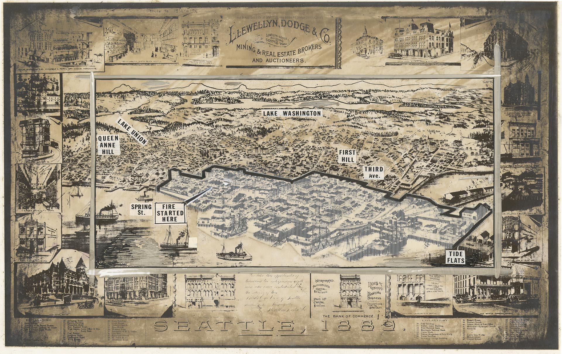
Map of Seattle, 1889, with Great Fire area drawn on top, circa 1990s
Order an ImageThis map of Seattle, prepared by Llewellyn, Dodge and Co. om 1889, presents a bird's-eye view of the city before the June 6, 1889 fire, facing northeast from Elliott Bay towards the Cascade Mountain Range. Here, a photograph of the map was created by Seattle Post-Intelligencer staff, and the area of the city affected by the fire indicated with an overlay, with labels indicating geographic landmarks, and the location of the start of the fire.
ID Number: 2000.107.273.03.01
Date: Circa 1990s
Physical Description: 1 photograph : b&w ; 12.75 x 8 in.
Credit: MOHAI, Seattle Post-Intelligencer Collection, 2000.107.273.03.01
Copyright: All Rights Reserved
Subjects:
Great Seattle Fire (1889)