Back to Results
1983.10.7767
View full size image or right-click on image to save
Photograph
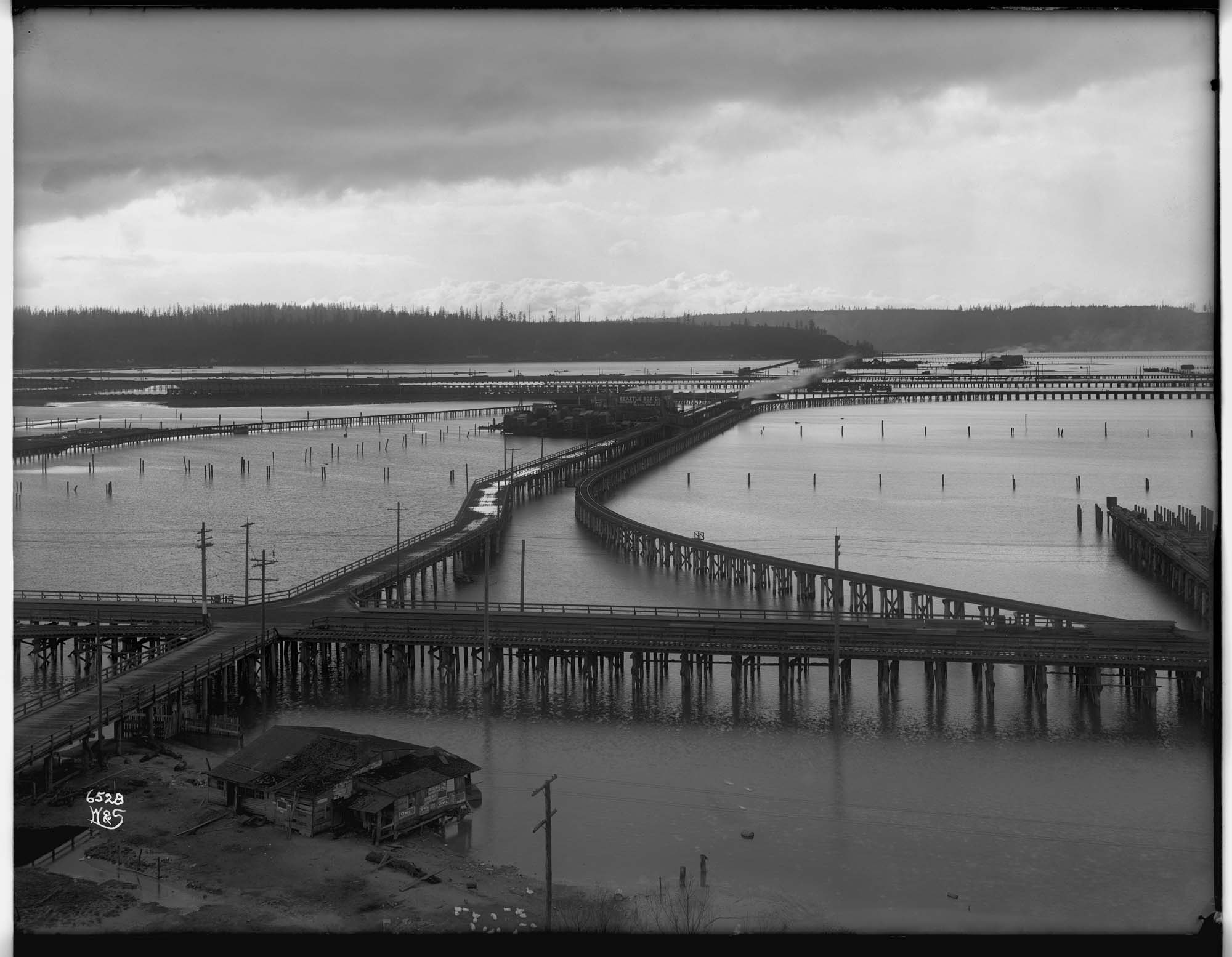
Trestles over the tidal flats, circa 1903
Order an ImageThe Duwamish River flowed out through tidal mudflats between Seattle and West Seattle. By the middle 1900s, several streets and railways ran over the tideflats on trestles. Much of this area was later filled in to become Harbor Island.
This photo, taken sometime between 1902 and 1904, shows the view from Seattle towards West Seattle. The nearest trestle, which runs straight across the photograph from left to right, follows the route of today's Airport Way. Spokane Street and a railroad trestle run diagonally towards West Seattle, past the Seattle Box Works. Fourth Avenue South is the first trestle in the distant right.
Original photograph: between 1902 and 1904. Copied by Webster & Stevens
Webster & Stevens number: 6528
This photo, taken sometime between 1902 and 1904, shows the view from Seattle towards West Seattle. The nearest trestle, which runs straight across the photograph from left to right, follows the route of today's Airport Way. Spokane Street and a railroad trestle run diagonally towards West Seattle, past the Seattle Box Works. Fourth Avenue South is the first trestle in the distant right.
Original photograph: between 1902 and 1904. Copied by Webster & Stevens
Webster & Stevens number: 6528
ID Number: 1983.10.7767
Date: Circa 1903
Creator(s):
Webster & Stevens, Photographer
Physical Description: 1 negative : glass, b&w ; 6.5 x 8.5 in.
Credit: MOHAI, PEMCO Webster & Stevens Collection, 1983.10.7767
Copyright: No Known Copyright
Other matching results
Four thousand salmon on dock, circa 1905
Ballard locks under construction, Seattle, circa 1913
Workers in salmon cannery, circa 1908
Group of Suquamish people waiting at Colman Dock, Seattle, circa 1911
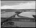
Trestles over the tidal flats, circa 1903
Photographer on beach near West Point Lighthouse, circa 1913
Magnolia Bluff, Seattle, circa 1913
Alki Beach, Seattle, circa 1911
Steamship "Minnesota," circa 1910