Back to Results
1983.10.17731.2
View full size image or right-click on image to save
Photograph
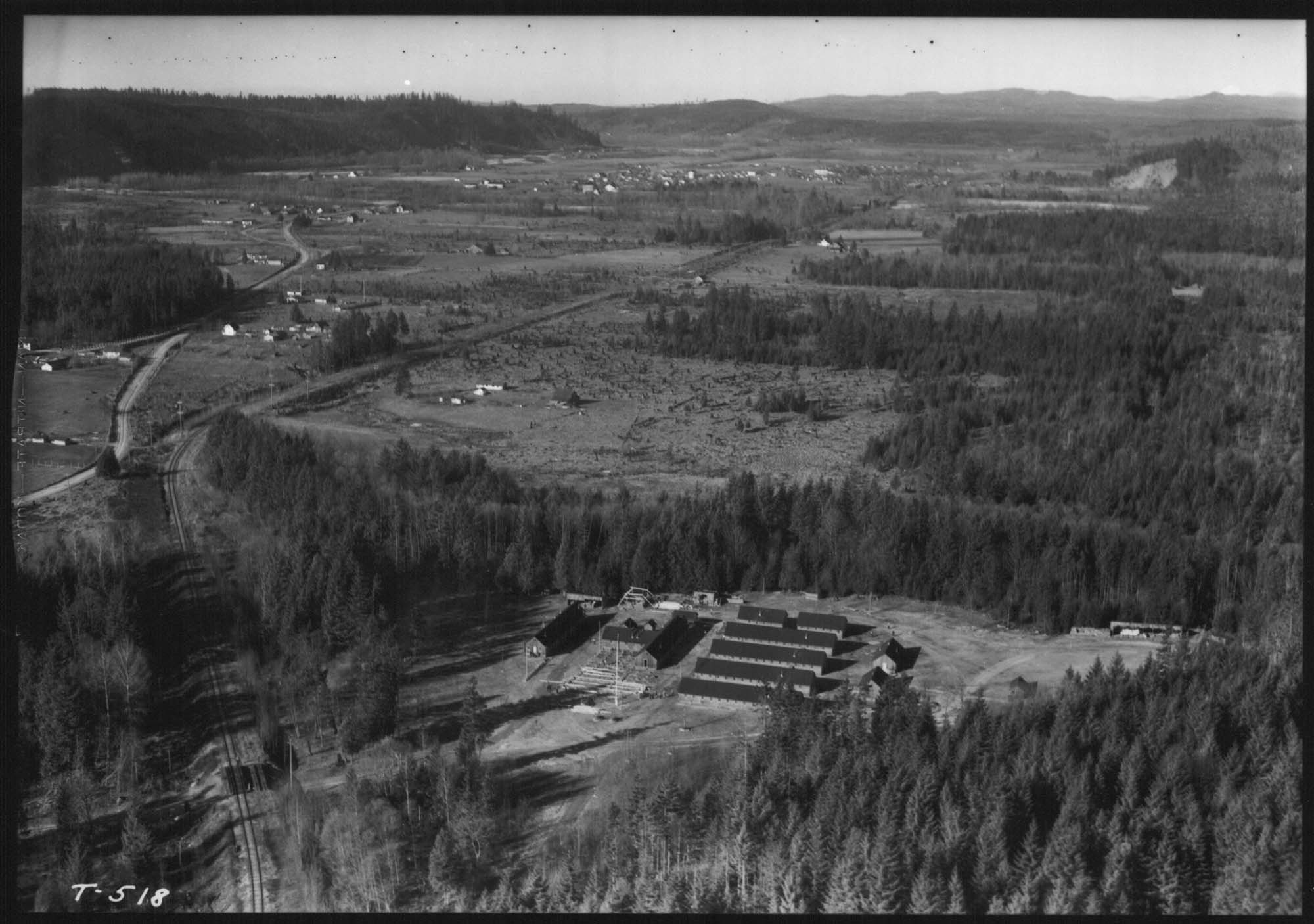
Aerial of Camp Cherry Valley, near Carnation, February 15, 1935
Order an ImageCamp Cherry Valley was a Civilian Conservation Corps (CCC) camp located in the Snoqualmie Valley on land leased from Weyerhaeuser. In 1935, the Washington State Department of Welfare took over the camp and used it as a location to house and feed homeless men in the area. The men were also given jobs constructing public works. During WWII the camp reverted to Weyerhaeuser, which sold the camp in 1952.
This aerial view looks north towards the town of Carnation (Tolt) in the distance. The Fall City-Carnation road runs along the left side, and the Milwaukee Railroad tracks are visible in the foreground.
Handwritten on sleeve: Camp Cherry Valley, near Carnation, WA - 2-16-35. [Transient Camp Relocation]
Webster & Stevens number: T-518
Caption information source: "Griffin Creek Park Natural Area Site Management Plan," King County Department of Construction and Facilities Management, p. 16, https://aqua.kingcounty.gov/dnrp/library/1999/kcr1223/griffin-creek-natural-area.pdf, retreived 9/14/2021.
This aerial view looks north towards the town of Carnation (Tolt) in the distance. The Fall City-Carnation road runs along the left side, and the Milwaukee Railroad tracks are visible in the foreground.
Handwritten on sleeve: Camp Cherry Valley, near Carnation, WA - 2-16-35. [Transient Camp Relocation]
Webster & Stevens number: T-518
Caption information source: "Griffin Creek Park Natural Area Site Management Plan," King County Department of Construction and Facilities Management, p. 16, https://aqua.kingcounty.gov/dnrp/library/1999/kcr1223/griffin-creek-natural-area.pdf, retreived 9/14/2021.
ID Number: 1983.10.17731.2
Date: 1935
Creator(s):
Laidlaw, Charles R., Photographer
Physical Description: 1 negative : nitrate, b&w ; 5 x 7 in. ; sulfiding
Credit: MOHAI, PEMCO Webster & Stevens Collection, 1983.10.17731.2, photo by Charles R. Laidlaw
Copyright: All Rights Reserved
Other matching results
Aerial view of Connecticut Street dock, Seattle, 1935
Aerial of Ford Motor Plant from southeast, Seattle, 1932
Young men leaving Seattle for a Civilian Conservation Corps camp, April 14, 1937
Young men in the Civilian Conservation Corps receiving a physical exam, 1937
Young bugler at a Civilian Conservation Corps camp, 1939
Buildings at a Washington state CCC camp, August 1939
Circle of children holding hands in a wooded clearing, 1939
Public employment office exterior showing men looking at listings, Seattle, 1936