Virgil Gay Bogue (1846-1916) was a civil engineer, originally from Norfolk, New York, who after working briefly as assistant engineer in Brooklyn, New York, and 10 years working with railroads in Peru, came to the Washington Territory in the 1880s as an employee of the Northern Pacific Railway. After a stint at the Union Pacific Railroad, Bogue started his own consulting engineer business in 1891. He would spend the next two decades consulting projects across the United States and in New Zealand, and in 1910 Bogue was hired by the Municipal Plans Commission of Seattle to beautify the city with a comprehensive city plan. Bogue published his "Plan for Seattle" on August 24, 1911, which was approved by the commission, but rejected in a public vote on March 5, 1912.
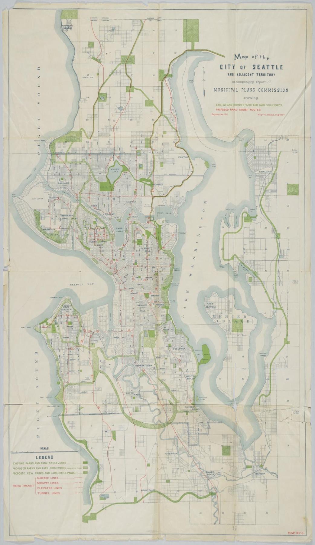
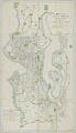
This Map No. 3 of the plan outlines existing and proposed parks, along with suggested rapid transit lines throughout Seattle and extending north to the Snohomish County line and east to Kirkland and Renton.
Text on map: Map of the City of Seattle and Adjacent Territory, accompanying report of Municipal Plans Commission showing Existing and Proposed Parks and Park Boulevards, Proposed Rapid Transit Routes, September 11, Virgil G. Bogue, Engineer. Map No. 3
Caption information source: "Bogue, Virgil Gay (1846-1916)," by Dotty DeCoster, HistoryLink.org Essay 9779, https://www.historylink.org/File/9779.