Back to Results
1968.4347.1
View full size image or right-click on image to save
Cartographic material
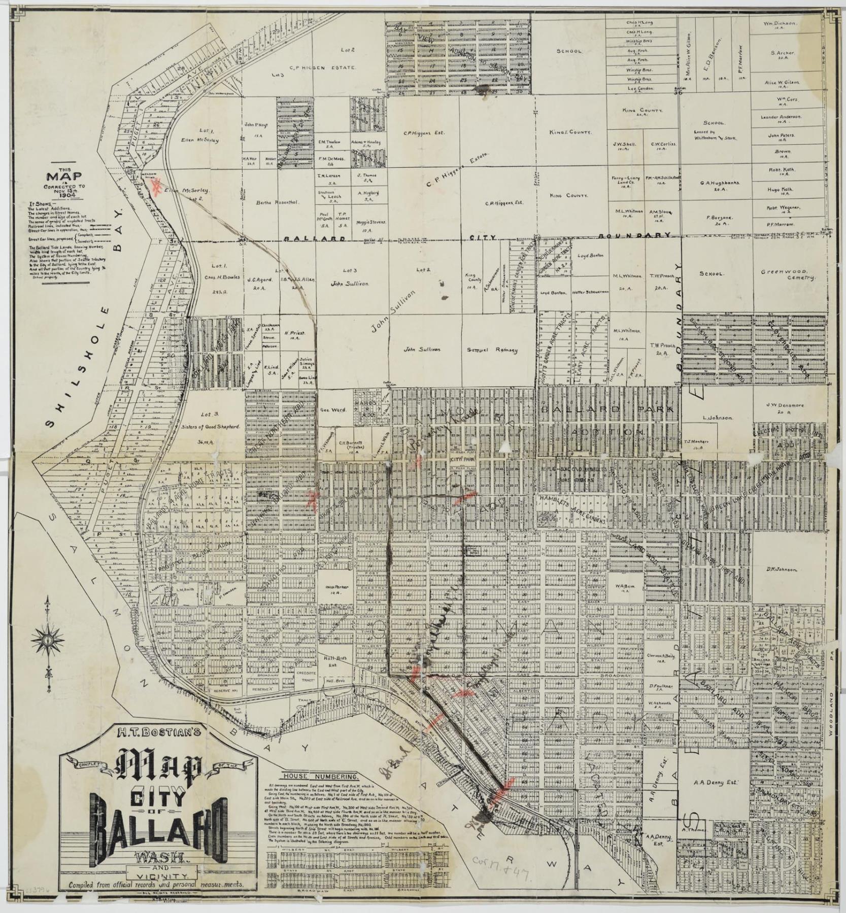
Complete Map of the City of Ballard, Wash. and Vicinity, November 15, 1904
Order an ImageSeattle's Ballard neighborhood was an independent city when it incorporated in 1890 until it was annexed by Seattle on May 29, 1907. Six months earlier the vote by Ballard citizens to join Seattle had passed by a narrow margin, 996 to 874.
The map pictured here was created three years before annexation and shows, among other features, "the changes in Street Names, the number and size of each lot, the names of owners of unplatted tracts, Railroad lines, Street Car lines," and house numberings. The hand-drawn map was created by Harry T. Bostian (1863-1933), the City Engineer of Ballard before and after incorporation. It was compiled from "official records and personal measurements" by Mr. Bostian.
Caption information source: "H.T. Bostian, Engineer Dies In Tacoma," The Seattle Daily Times, September 24, 1933, p.2.
Caption information source: "Seattle Neighborhoods: Ballard - Thumbnail History," by Walt Crowley, HistoryLink.org Essay 983.
The map pictured here was created three years before annexation and shows, among other features, "the changes in Street Names, the number and size of each lot, the names of owners of unplatted tracts, Railroad lines, Street Car lines," and house numberings. The hand-drawn map was created by Harry T. Bostian (1863-1933), the City Engineer of Ballard before and after incorporation. It was compiled from "official records and personal measurements" by Mr. Bostian.
Caption information source: "H.T. Bostian, Engineer Dies In Tacoma," The Seattle Daily Times, September 24, 1933, p.2.
Caption information source: "Seattle Neighborhoods: Ballard - Thumbnail History," by Walt Crowley, HistoryLink.org Essay 983.
ID Number: 1968.4347.1
Date: 1904
Creator(s):
Bostian, Harry T., Creator
Physical Description: 1 map : b&w ; 21 x 22.5 in.
Additional Information: Digital copy of this item available thanks to funding from a 2016 Institute for Museum and Library Services grant.
Credit: MOHAI, 1968.4347.1
Copyright: No Known Copyright
Subjects:
Neighborhoods