Back to Results
1952.986.57.1_1
1952.986.57.1_2_a
1952.986.57.1_2_b
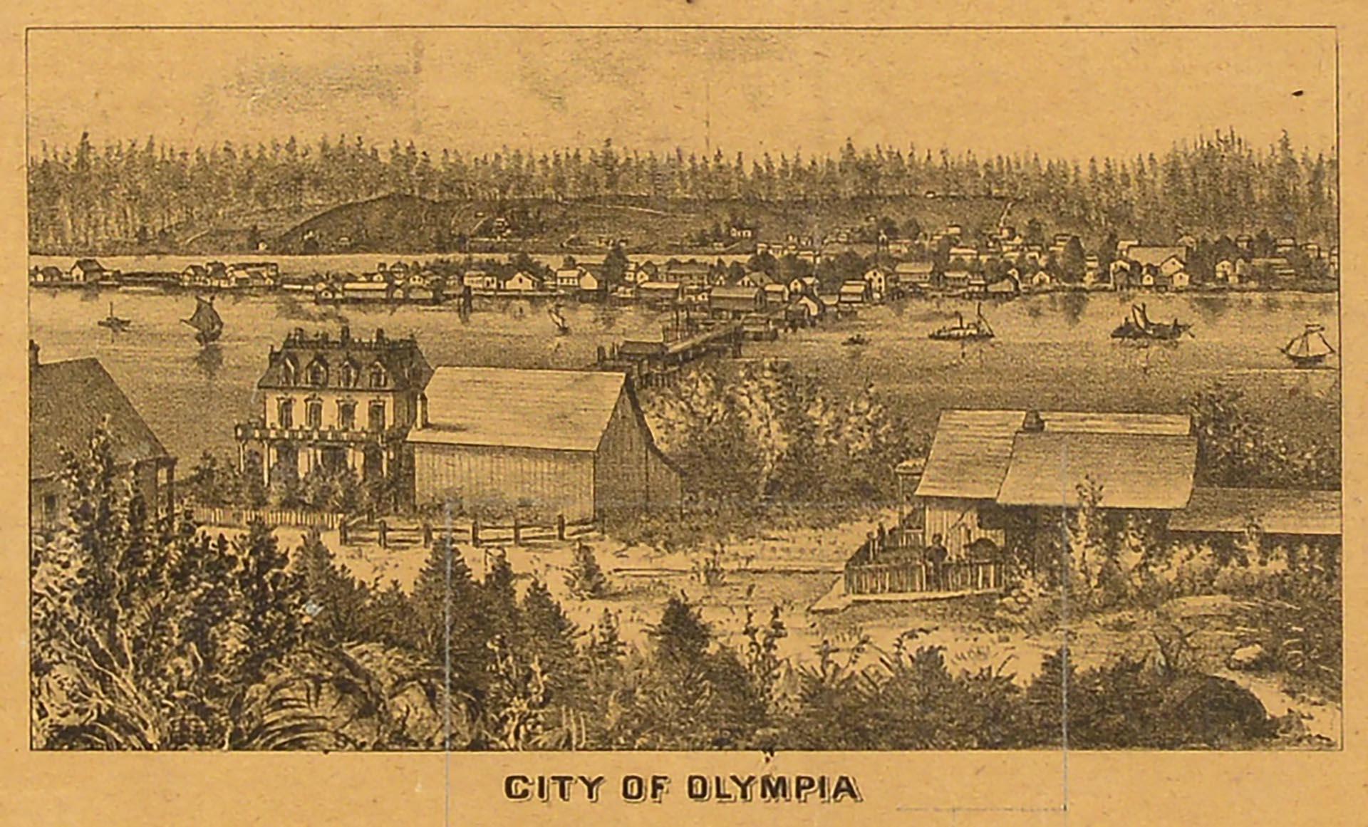
1952.986.57.1_3_a
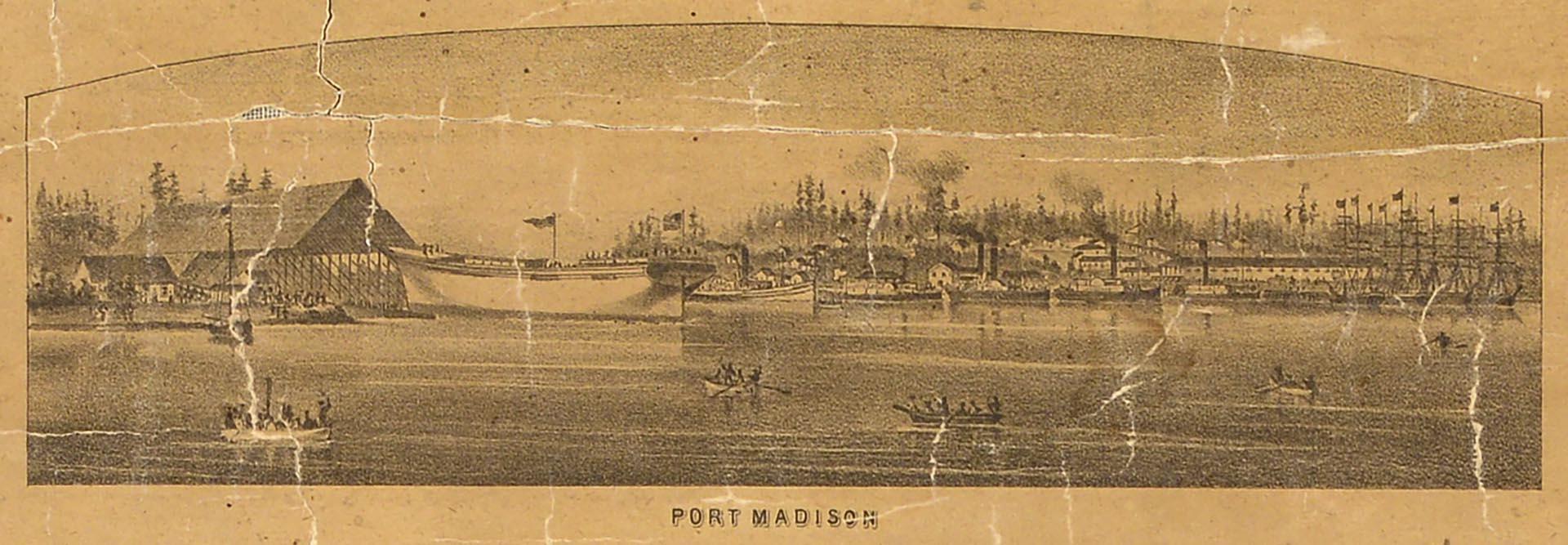
1952.986.57.1_4_a
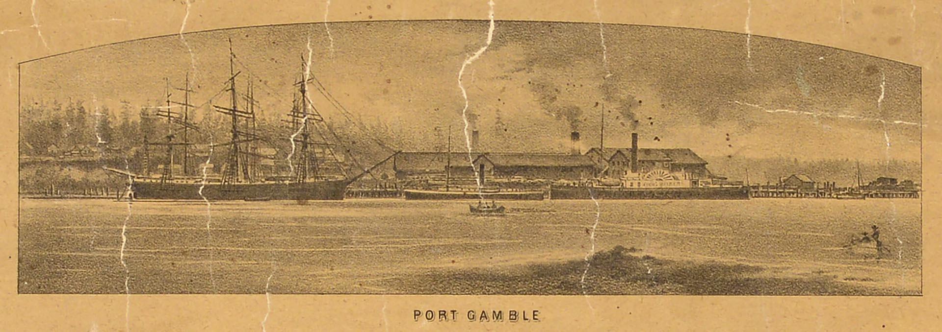
1952.986.57.1_4_b
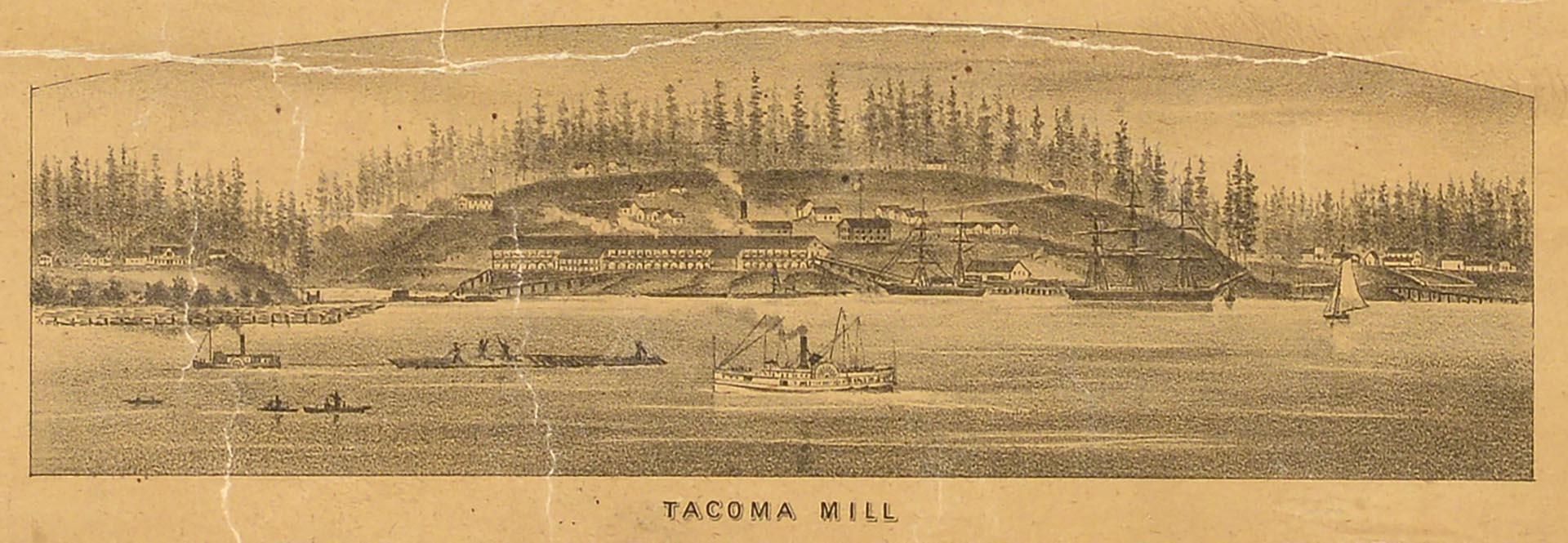
1952.986.57.1_4_c
1952.986.57.1_4_d
View full size image or right-click on image to save
View full size image or right-click on image to save
View full size image or right-click on image to save
View full size image or right-click on image to save
View full size image or right-click on image to save
View full size image or right-click on image to save
View full size image or right-click on image to save
View full size image or right-click on image to save
Cartographic material
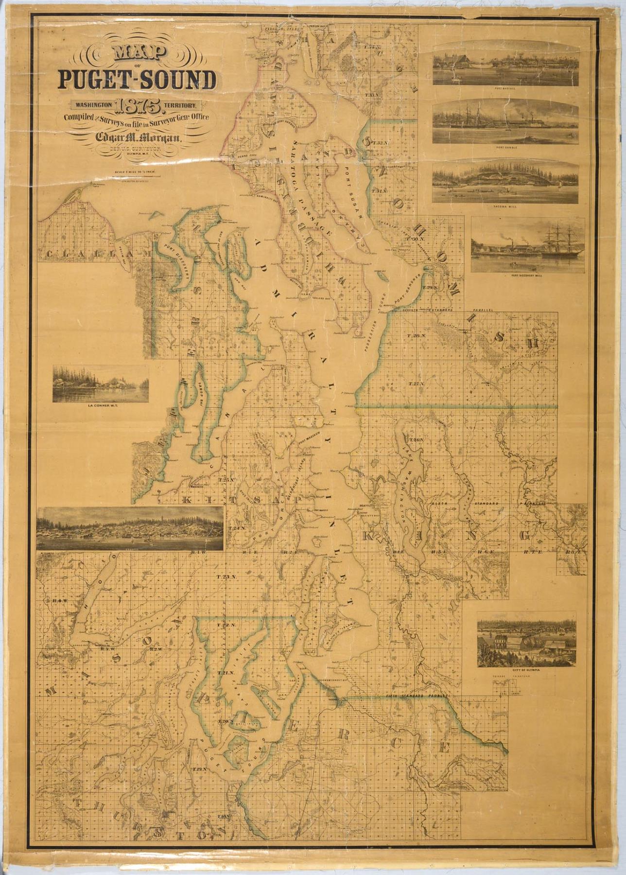
Map of Puget-Sound, Washington Territory, 1875
Order an ImageIn 1800, the United States Congress created local Land Offices to facilitate the selling of land to settlers. Each office had a Register to handle sales and documentation, a Receiver to oversee the money, and a Surveyor General who provided plat maps, one of which was logged in the Land Office. In 1852, over one year after the Washington Territory was created, the Surveyor General position was created for the new territory.
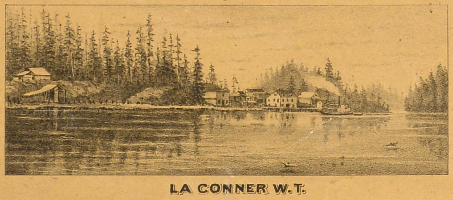
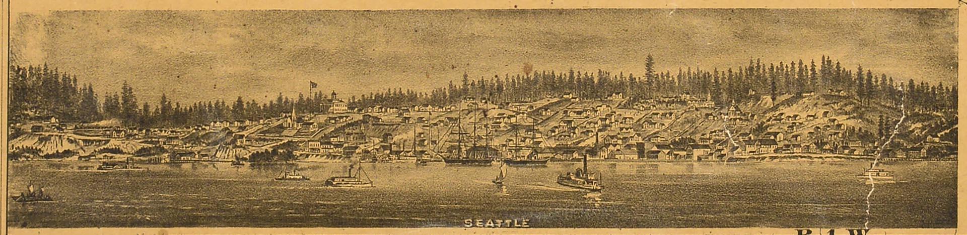
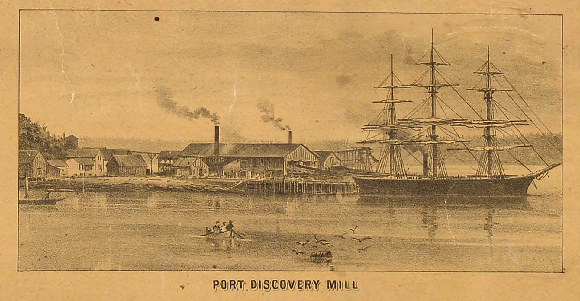
Deputy Surveyor General Edgar M. Morgan compiled this map of the Puget Sound region from surveys on file in 1875, stretching from Fidalgo Island in Whatcom County to the north to Tumwater in Thurston County in the south, Mt. Olympus in Mason County in the west to Fall City in King County to the east. The map covers portions of 10 counties (Clallam, Jefferson, Kitsap, Mason, Thurston, Pierce, King, Snohomish, Islands, and Whatcom), with lithograph illustrations of seven locations (La Connor, Seattle, Olympia, Port Discovery Mill, Tacoma Mill, Port Gamble, and Port Madison).
Written on map: Map of Puget-Sound, Washington Territory, 1875. Compiled from Surveys on file in Surveyor Gens Office by Edgar M. Morgan, Dep. U. S. Surveyor, Olympia, W.T., Scale 1 mile to 1/2 inch. Lith. Britton, Rey & Co., S.F.
Caption information source: "A Brief History of the General Land Office in Washington," excerpt from Surveying North of the River, by Jerry C. Olson (Second Edition, 2018), http://www.olsonengr.com/sites/default/files/surveying-history/files/briefhistory.pdf
Deputy Surveyor General Edgar M. Morgan compiled this map of the Puget Sound region from surveys on file in 1875, stretching from Fidalgo Island in Whatcom County to the north to Tumwater in Thurston County in the south, Mt. Olympus in Mason County in the west to Fall City in King County to the east. The map covers portions of 10 counties (Clallam, Jefferson, Kitsap, Mason, Thurston, Pierce, King, Snohomish, Islands, and Whatcom), with lithograph illustrations of seven locations (La Connor, Seattle, Olympia, Port Discovery Mill, Tacoma Mill, Port Gamble, and Port Madison).
Written on map: Map of Puget-Sound, Washington Territory, 1875. Compiled from Surveys on file in Surveyor Gens Office by Edgar M. Morgan, Dep. U. S. Surveyor, Olympia, W.T., Scale 1 mile to 1/2 inch. Lith. Britton, Rey & Co., S.F.
Caption information source: "A Brief History of the General Land Office in Washington," excerpt from Surveying North of the River, by Jerry C. Olson (Second Edition, 2018), http://www.olsonengr.com/sites/default/files/surveying-history/files/briefhistory.pdf
ID Number: 1952.986.57.1
Date: 1875
Creator(s):
Morgan, Edgar M., Creator
Physical Description: 1 map : color ; 39 x 53.5 in.
Additional Information: Digital copy of this item available thanks to funding from a 2016 Institute for Museum and Library Services grant.
Credit: MOHAI, Sophie Frye Bass Collection, 1952.986.57.1
Copyright: No Known Copyright
Other matching results
Survivor's Pension Certificate issued to Carson D. Boren, May 20, 1903
Seattle Electric Company ticket, Seattle, 1903

Puget Sound Electric Railway time table, 1904
Coastal steamship "Corona," circa 1900
Brig "Tanner," 1902

Coast Salish canoe in Port Townsend Bay, circa 1900
Puget Sound Bridge & Dredging Company, September 30, 1940
Puget Sound Bridge & Dredging Company, July 8, 1943